Bay and Gulf County seawall guides. Find your shoreline.
Pick your waterfront to see the permit office, shoreline rules and storm record that apply there, across 12 Bay County areas and 4 on the Gulf County coast.
Find your waterfront
Explore the coast. Find your starting point.
Sixteen guides across Bay County and the Gulf County coast. Each covers who issues permits there, what the water does and what to check on your wall.
Full local guide
Choose a label to open local resources →Tap a community on the map or below ↗
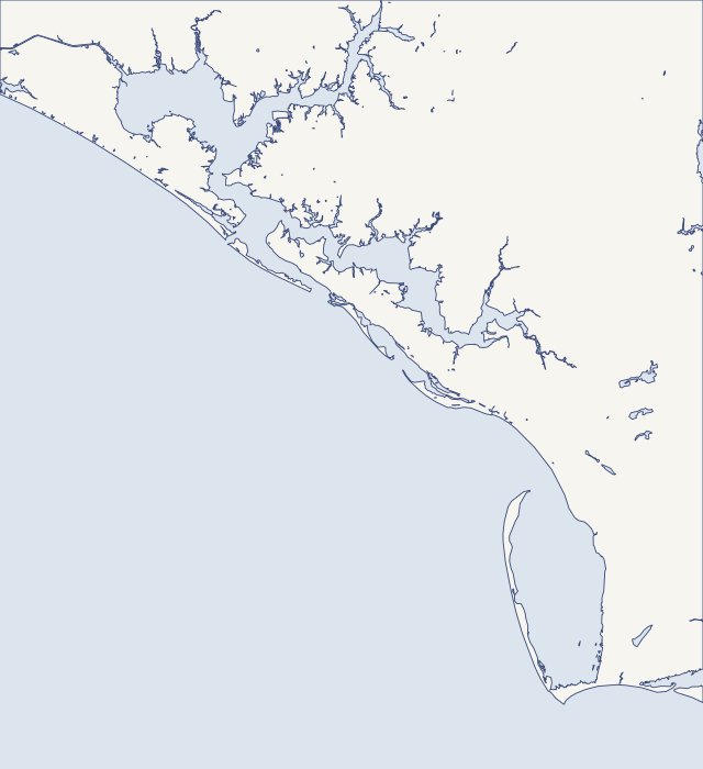
Land and water: U.S. Census Bureau TIGERweb, 2026. Reference points: USGS GNIS and NOAA CO-OPS. General orientation only; not a survey, flood map or service boundary.
Your local starting point
Find your community.
Choose a guide for local maps, permit starting points and the records to gather for your property.
Grand Lagoon is a dredged arm of St. Andrew Bay that runs about 5 miles northwest from just inside the bay entrance. All 9,233 Bay County address points around the lagoon and Bay Point are coded unincorporated, even though their mail says Panama City Beach. On Thomas Drive, the 2,554 points along its eastern stretch are all county. That makes Bay County Building Safety the usual seawall permit office. Parts of the lagoon and the Magnolia Beach shore also fall inside the Navy's water-interface area for Naval Support Activity Panama City.
This guide covers the open Gulf beach along Front Beach Road, from the Laguna Beach end east toward Thomas Drive. The beach is a federally renourished dune and berm system, and the whole Bay County shore west of St. Andrews Inlet is designated critically eroded. The middle of the strip lies inside the City of Panama City Beach, but both ends hold unincorporated county pockets. Seaward of the Coastal Construction Control Line, the state's beach construction boundary, DEP permits come first.
The west end has two shorelines. On the Gulf side, Pinnacle Port, Carillon and Ramsgate front a renourished beach in unincorporated Bay County. Inland, Lake Powell is a coastal dune lake and an Outstanding Florida Water, the state's top water-quality class. Its level is managed by digging open Phillips Inlet when the lake runs high, so lakefront walls answer to rain and inlet openings rather than daily tides.
West Bay is the northwest arm of St. Andrew Bay, edged by salt marsh, oyster bars and seagrass and fed by Burnt Mill and Crooked creeks. About 14.4 of its 30 miles of shorefront would stay natural under conservation plans. Burnt Mill Creek Road and West Bay Parkway are unincorporated, while Breakfast Point Boulevard splits between Panama City Beach and the county. Plan a dock across marsh before you plan a wall.
Historic St. Andrews sits on St. Andrew Bay around Buena Vista Point, with Lake Huntington and Lake Ware close by. The neighborhood has been a Panama City redevelopment area since 1989, and permits come from city offices on Harrison Avenue, not the county. St. Andrews Marina is man-made land filled behind bulkheads around 1958, and its failing wall is now being rebuilt in public view.
Downtown Panama City wraps around St. Andrew Bay with three tight waterways: Massalina Bayou, Watson Bayou running north past historic Millville, and Bunkers Cove. Every address checked on Bunkers Cove Road and Cove Terrace is inside the City of Panama City. Low bridges cross both bayous, and NOAA's Panama City tide station sits on this stretch of the bay.
Pretty Bayou, Robinson Bayou and Posten Bayou open onto North Bay on the north side of Panama City. Bay County's address layer codes nearly every Pretty Bayou street as unincorporated county land, while Calabria Road in Venetian Villa sits inside the City of Panama City. Hurricane Michael pushed an estimated 4 to 6 feet of surge around Panama City and St. Andrew Bay in 2018.
Five Lynn Haven steps in the order the city expects
Lynn Haven sits on North Bay among Lynn Haven, Anderson, Goose and Mill bayous. NOAA's Coast Pilot gives North Bay a controlling depth of 12 feet up to the Lynn Haven bridge, then only 4.5 feet to Deer Point Dam. Oyster bars sit mid-bay. City limits stop short of some bayou roads, so Goose Bayou Road and Mill Bayou Road addresses are county land despite the 32444 ZIP.
Deer Point Lake is a freshwater reservoir created in 1961, when a sheet pile dam closed off the top of North Bay about three miles northeast of Lynn Haven. Econfina, Bear and Cedar creeks and Bayou George feed it, and it is Bay County's main drinking water source. Below the dam, Fannin Bayou and the Southport shore are saltwater. Nearly every Southport address is unincorporated county land.
East Bay homeowner checklist for Callaway and Parker
Callaway and Parker share the shore of East Bay. Much of Callaway's housing lines East Bay and Callaway Bayou, while Parker fronts East Bay and Martin Lake, with Parker Bayou and Pitts Bayou close by. Water makes up about a fifth of Parker's area, the most of any East Bay city. Hurricane Michael's eye crossed here in 2018, and a storm chaser measured 923 millibars inside it in Callaway.
Planning a shoreline on the marsh side of East Bay
This is the upper end of East Bay, an arm of St. Andrew Bay of about 18,700 acres fed by Sandy and Wetappo creeks and ten bayous. The Intracoastal Waterway enters East Bay through a cut in Wetappo Creek. Allanton and Sandy Creek are not among Bay County's seven cities, so county offices issue permits. Tyndall Air Force Base is a close neighbor, with its own reef work at Baker's Point.
Mexico Beach sits at the Gulf County line, where Hurricane Michael made landfall as a category 5 on October 10, 2018. NHC put the surge at 9 to 14 feet above ground, highest here. The canal follows the old path of Salt Creek and runs about 10,000 feet along the city's north side to a jettied inlet. Every city address uses ZIP 32456, which Port St. Joe shares.
Port St. Joe sits on the northeast shore of St. Joseph Bay, a clear, salty lagoon that is also a state aquatic preserve. Inside city limits, the first 50 feet inland from the bay’s mean high water line is a protection zone. Highland View and Oak Grove are county land, where the comprehensive plan bars new vertical seawalls. Daily tides are small, so storm surge, not tide, is what tests a bay wall here.
A Gulf-front checklist for Beacon Hill and WindMark
St. Joe Beach, Beacon Hill and WindMark line the Gulf-front mainland of Gulf County east of the Bay County line. Exposure changes fast along this shore. Michael’s water reached +21.2 feet NAVD88 at the west end of Beacon Hill, but only about +11 feet at WindMark, which St. Joseph Peninsula shelters. Most shoreline work here is dune and CCCL work rather than bulkhead work.
St. Joseph Peninsula is a 17-mile barrier spit with the Gulf on its west side and St. Joseph Bay on its east. Erosion peaks near Stump Hole, and the cape’s west shore has lost about 40 feet a year on average. Bay-side lots are exposed too, because Michael’s surge crossed the isthmus from the bay. Check the federal coastal barrier map before you budget a rebuild.
Indian Pass sits at the east end of Gulf County, where the quiet, gently sloping beach of Indian Peninsula meets the inlet to St. Vincent Sound. Behind it lies Indian Lagoon, a shellfish harvesting area, with Money Bayou to the west. Lagoon lots carry a 50-foot high-quality wetland setback, and the inlet end eroded hard in Michael while the beach to the west held.