
Grand Lagoon seawall and bulkhead planning
Grand Lagoon seawall repair runs through Bay County, because nearly every lagoon, Bay Point and east Thomas Drive address sits outside Panama City Beach city limits. Start with the county permit, then plan equipment access and water-quality controls.
Describe your project on this page ↓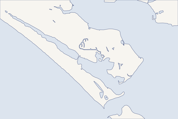
Grand Lagoon, Thomas Drive & Bay Point at a glance
- Who permits it
- Bay County, not the city. All 9,233 address points around the lagoon and Bay Point are unincorporated.
- Call first
- Bay County Building Safety, (850) 248-8350
- The water
- Grand Lagoon, a dredged arm of St. Andrew Bay about 5 miles long. The State Road 392 bridge has 18 feet of clearance.
- Local rule to know
- Docks and lifts inside the Navy's water-interface area get an extra Planning and Zoning review.
Get to know your waterfront
Grand Lagoon is a dredged arm of St. Andrew Bay that runs about 5 miles northwest from just inside the bay entrance. All 9,233 Bay County address points around the lagoon and Bay Point are coded unincorporated, even though their mail says Panama City Beach. On Thomas Drive, the 2,554 points along its eastern stretch are all county. That makes Bay County Building Safety the usual seawall permit office. Parts of the lagoon and the Magnolia Beach shore also fall inside the Navy's water-interface area for Naval Support Activity Panama City.
U.S. Coast Pilot 5 (2026), Chapter 6 · BayView map service - Addresses layer (CITY and CMNTY fields) · Permits | Bay County, FL · Departmental/Planning map service - Land Use Water Interface Military Influence Area (layer 14)
What to settle before a Grand Lagoon wall is designed
Settle three things first: which government issues the permit, whether the Navy reviews your dock, and how equipment will reach the wall. Each one changes the schedule and the bid.
Your mail says Panama City Beach. Your permit says Bay County.
Bay County's address layer records the legal jurisdiction separately from the mailing name. In ZIP 32408, 17,210 address points with a Panama City Beach mailing address are unincorporated, against 3,400 inside the city. County address layer The lagoon streets show the pattern clearly. Lagoon street counts Thomas Drive split
| Street | Unincorporated Bay County | City of Panama City Beach |
|---|---|---|
N Lagoon Dr | 674 | 1 |
S Lagoon Dr | 360 | 0 |
Bay Point Rd | 289 | 0 |
Magnolia Beach Rd | 92 | 0 |
Gulf Dr | 425 | 0 |
Thomas Dr, whole street | 3,178 | 2,877 (all at the northwest end) |
For a county lot, any new dock or seawall, and any structural change or repair, needs a Building permit from Bay County. County permit trigger The Bay County seawall guide shows the parcel check and Form B36, and the permit guide covers the state and federal steps.
Docks near the Navy get a second look
Bay County's Navy overlay sends every development-order application for a dock, pier, boat slip, launch or marina inside the water-interface area to Planning and Zoning. Staff check it against the Navy's water-based activities. LDR Section 1003.9
A county map check placed shoreline points on Hatteras Lane near Bay Point Marina, on Lagoon Drive and on Magnolia Beach Road inside that area. Water-interface map check If your seawall job includes a new dock or lift, add time for this review. Bay Point lots can also carry parcel-specific county resolutions adopted up to January 1, 2026. Bay Point special treatment zone
How will the barge reach your wall?
Ask every bidder how they will reach the lot. A barge is a floating work platform that carries the crane and the sheet pile (interlocking wall panels driven into the bottom). These limits apply in and near the lagoon:
- The fixed State Road 392 bridge over the lagoon has 18 feet of vertical clearance, and an overhead cable just west of it is authorized at 36 feet. Coast Pilot
- Water within about 100 feet of mean high water (the average high-tide line) along the Navy base is a restricted area, including across the mouth of Alligator Bayou. No vessel may enter, anchor or drift there without written Navy permission. 33 CFR 334.760
- A dredged, lighted channel serves both the north and south shores, and marinas near the bridge list fuel and a 30-ton mobile hoist. Coast Pilot
If the crew must work from land instead, the quote should show the access route, yard restoration and any neighbor permission.
Expect close attention to muddy water and runoff
The county describes Grand Lagoon as one of the older developed parts of Panama City Beach without stormwater treatment. It built a regional stormwater facility that treats water flowing into the lagoon. Surtax project record A septic-to-sewer project with the City of Panama City Beach was set up to remove about 55 septic systems in the basin. NWFWMD project notice
On August 26, 2026, the health department issued a water quality advisory for the lagoon from Joan Avenue to Navy Boulevard after a failed bacteria test. DOH-Bay advisory Bay County requires temporary erosion controls for work next to a shoreline. LDR 1904(2) Ask your engineer to show turbidity curtains (floating silt barriers) and how yard drainage will cross the new cap, the concrete beam along the top of the wall. The soil loss and drainage guide covers weep holes and filter fabric.
Storm water levels inside and outside the pass
The lagoon lies between two NOAA gauges that peaked very differently in recent storms. Michael came ashore east of the bay, and Isaias came ashore to the west. NHC Michael report NHC Isaias discussion
| Storm | Gulf pier, Panama City Beach | Panama City gauge, St. Andrew Bay |
|---|---|---|
Michael, 2018 | 3.9 ft | 5.3 ft |
Isaias, 2026 | 5.6 ft | 3.0 ft |
Read both rows with your engineer before setting a cap height. Gulf pier records Panama City records DEP found Michael eroded the state park beach more than the renourished beach to the west, with up to about 50 feet of dune loss at monument R96. Its report does not count bayside seawall damage in the lagoon. DEP Michael report
A living shoreline has already been built here
In Upper Grand Lagoon, a 2010 project on the Navy base built about 1 acre of oyster reef and half an acre of marsh. The goal was to slow erosion that threatened seagrass. NOAA Restoration Atlas EPA's award notice put the treated shoreline at 2,800 feet. EPA Gulf Guardian release On a calm lagoon lot, ask whether a living shoreline or a rock toe could replace part of a vertical bulkhead.
Grand Lagoon in one line: confirm the county jurisdiction, ask Planning about the Navy layer, and make bidders explain water access before you compare prices. Owners on the beach side of Thomas Drive face the state's coastal construction line instead; see Gulf-front Panama City Beach.
What could the work cost?
Ask each Grand Lagoon bidder to price water access apart from the wall itself, including barge time, any land route and yard restoration. Silt controls in the water, dock or lift removal and the engineered drawings the county requires should each be a separate line, so three bids can be compared on the same scope.
No public record found in Bay or Gulf County shows what a private homeowner paid per foot for a seawall. This guide shows real public bids, FEMA worksheets and fee schedules instead, each with its year, place and scope.
Compare quotes and plan a budget →Find the relevant permits and records
| Starting point | What to resolve | Prepare and look up |
|---|---|---|
Bay County Building Safety Division | Building permit for any new dock or seawall, and any structural change or repair, on unincorporated lots. | Form B36 package: engineered seawall design, site plan with equipment location, notarized application and a certified Notice of Commencement over $5,000. 840 W 11th Street, Panama City; (850) 248-8350. |
Bay County Planning and Zoning | Navy water-interface review for docks, slips and launches; Bay Point parcel resolutions. | Parcel number and dock layout. Ask whether the lot is inside Map 10.7 and whether a Bay Point resolution applies. (850) 248-8250. |
DEP Northwest District, Panama City Branch | State exemption or permit for the wall, and consent to use state-owned bay bottom. | Survey showing the old and new wall faces. Restoration in place, farther inland or up to 18 inches farther out may qualify for an exemption. 2420 Jenks Ave.; (850) 872-4375. |
U.S. Army Corps of Engineers, Panama City Permits Section | Federal authorization for work in navigable water. | The same drawings as the state file. A state approval does not replace the federal one. (850) 763-0717. |
Grand Lagoon pre-bid checklist
Work through these four checks before you invite bids. Each one uses a public record you can pull yourself.
Read the tax district on the parcel
Look the parcel up on the Bay County Property Appraiser search. A lot inside Panama City Beach shows Tax Area 13; any other code on the lagoon points to a different office.
Find a Permit / Inspection Results · Bay County Property Appraiser
Pull the wall's permit history
Search the Bay County portal by parcel number and look for PRDC records, the county prefix for dock and seawall permits. A missing record is a question for the seller, not proof of unpermitted work.
How to search permit information in Unincorporated Bay County
Ask Planning two questions
Is the lot in the Navy water-interface area, and does a Bay Point resolution cover it? Get both answers in writing before the dock is designed.
Bay County Land Development Regulations, Chapter 10 Special Treatment Zones
Make access part of the bid
Give bidders the 18-foot bridge clearance and the Navy no-entry zone up front. Ask each one to name its barge or land route and the crane it plans to use.
U.S. Coast Pilot 5 (2026), Chapter 6 · 33 CFR 334.760 Naval Support Activity Panama City and Alligator Bayou; naval restricted area
Tell us about your Grand Lagoon wall
Share your street, what you see along the wall and whether a dock or lift is involved. We will help you plan the next step and find a qualified marine contractor who works on the lagoon.
Built on Bay and Gulf County permit rules, public records and storm data.
Grand Lagoon, Thomas Drive & Bay Point project questions
My address says Panama City Beach. Why does Bay County issue my seawall permit?
The mailing name and the legal jurisdiction are recorded separately. Every address point around Grand Lagoon and Bay Point is coded unincorporated, so Bay County Building Safety, (850) 248-8350, handles the permit.
BayView map service - Addresses layer (CITY and CMNTY fields) · Permits | Bay County, FL
Is Grand Lagoon inside the St. Andrews Aquatic Preserve?
Check before you design. The preserve covers state-owned bottom below mean high water in the St. Andrew Bay entrance area, and artificial canals are excluded. DEP's preserve office at (850) 670-7747 can say whether your shoreline fronts preserve water.
St. Andrews Aquatic Preserve Management Plan · St. Andrews Aquatic Preserve | Florida Aquatic Preserves
What changes if my lot does front preserve water?
Preserve rules bar new seawalls out past the mean high water line. Restoring a wall at its old line, farther inland or up to one foot farther out needs no separate consent of use. Single-family docks are held to a 4-foot-wide access walkway and a 160-square-foot terminal platform.
Rule 18-20.004 Management Policies, Standards and Criteria · Rule 18-20.004, F.A.C., Management Policies, Standards, and Criteria (aquatic preserves)
Does the lagoon's water quality affect a seawall job?
It shapes the work plan. The lagoon had a health advisory in August 2026, and county rules require temporary erosion controls beside any shoreline. Ask how the crew will contain muddy water while it works.
DOH-Bay Issues Water Quality Health Advisory · Bay County Land Development Regulations, Section 1904
Keep planning
Nearby waterfront guides
Gulf-front Panama City Beach, Historic St. Andrews, Downtown Panama City, Massalina & Watson Bayous
Show sourcesHide sources
- U.S. Coast Pilot 5 (2026), Chapter 6Source reviewed 2026-10-28
- BayView map service - Addresses layer (CITY and CMNTY fields)Source reviewed 2026-10-28
- Permits | Bay County, FLSource reviewed 2026-10-28
- Departmental/Planning map service - Land Use Water Interface Military Influence Area (layer 14)Source reviewed 2026-10-28
- Bay County Land Development Regulations, Chapter 10 Special Treatment ZonesSource reviewed 2026-10-28
- 33 CFR 334.760 Naval Support Activity Panama City and Alligator Bayou; naval restricted areaSource reviewed 2026-10-28
- SurtaxProjects map service - Point Projects (Grand Lagoon Regional Stormwater Facility)Source reviewed 2026-10-28
- District joins city of Panama City Beach to protect Grand LagoonSource reviewed 2026-10-28
- DOH-Bay Issues Water Quality Health AdvisorySource reviewed 2026-10-28
- Bay County Land Development Regulations, Section 1904Source reviewed 2026-10-28
- National Hurricane Center Tropical Cyclone Report: Hurricane Michael (AL142018), 7-11 October 2018Source reviewed 2026-10-28
- Hurricane Isaias Discussion Number 14 (AL092026), 1000 PM CDT Fri Oct 09 2026Source reviewed 2026-10-28
- CO-OPS Top Ten Water Levels: Panama City Beach, FLSource reviewed 2026-10-28
- CO-OPS Top Ten Water Levels: Panama City, FLSource reviewed 2026-10-28
- Hurricane Michael Post-Storm Beach Conditions and Coastal Impact Report (April 2019)Source reviewed 2026-10-28
- Naval Support Activities Shoreline Restoration Project in St. Andrews Bay (RCDB 2744)Source reviewed 2026-10-28
- EPA Gulf of Mexico Program Gulf Guardian Awards 2013 (news release)Source reviewed 2026-10-28
- Dock and Seawall Permit Packet (Forms B36, B03, B05)Source reviewed 2026-10-28
- Planning & Zoning | Bay County, FLSource reviewed 2026-10-28
- Northwest District | Florida Department of Environmental ProtectionSource reviewed 2026-10-28
- 2026 Florida Statutes section 403.813Source reviewed 2026-10-27
- Sovereign Submerged Lands: Proprietary Authority versus Regulatory AuthoritySource reviewed 2026-10-23
- Jacksonville District Regulatory Office LocationsSource reviewed 2026-10-28
- USACE South Atlantic Division Florida regulatory guidanceSource reviewed 2026-10-27
- Find a Permit / Inspection ResultsSource reviewed 2026-10-28
- Bay County Property AppraiserSource reviewed 2026-10-28
- How to search permit information in Unincorporated Bay CountySource reviewed 2026-10-28
- St. Andrews Aquatic Preserve Management PlanSource reviewed 2026-10-28
- St. Andrews Aquatic Preserve | Florida Aquatic PreservesSource reviewed 2026-10-28
- Rule 18-20.004 Management Policies, Standards and CriteriaSource reviewed 2026-10-28
- Rule 18-20.004, F.A.C., Management Policies, Standards, and Criteria (aquatic preserves)Source reviewed 2026-10-28