
Downtown Panama City bayou seawall planning
Downtown Panama City seawall and dock work on Massalina Bayou, Watson Bayou and the Cove is city-permitted and short on space. Narrow water, riparian lines and low bridges shape the design before price does.
Describe your project on this page ↓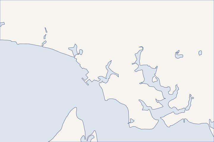
Downtown Panama City, Massalina & Watson Bayous at a glance
- Who permits it
- City of Panama City. Every address checked on Bunkers Cove Road and Cove Terrace is inside the city.
- Call first
- Panama City Building Services, (850) 872-3025
- The water
- Massalina Bayou, Watson Bayou and Bunkers Cove, narrow water crossed by low bridges
- Local rule to know
- A dock may take no more than 20% of the waterbody's width and must stay at least 5 feet from the riparian line.
Get to know your waterfront
Downtown Panama City wraps around St. Andrew Bay with three tight waterways: Massalina Bayou, Watson Bayou running north past historic Millville, and Bunkers Cove. Every address checked on Bunkers Cove Road and Cove Terrace is inside the City of Panama City. Low bridges cross both bayous, and NOAA's Panama City tide station sits on this stretch of the bay.
GNIS Domestic Names - Florida (DomesticNames_FL.txt) · United States Coast Pilot 5, Chapter 6 (St. Andrew Bay) · Millville CRA · BayView map service, address points layer (0) · CO-OPS station metadata: 8729108 Panama City, FL
Limits that shape a bayou lot project
On a downtown bayou, the lot's width and the water's width set the design. Start with the city's dock rules and a riparian survey before any seawall or bulkhead drawing, then sort out how the equipment gets in.
The city's dock rules on narrow water
Panama City's dock guide applies across the city, and on a narrow bayou several limits can bind at once. Dock applicant guide
| Rule | Limit | What to check on a bayou |
|---|---|---|
Boat slips | Two per lot | Decide early which boats you will keep. |
Side setback | 25 ft with a walkway on lots with 65 ft or more of shoreline (10 ft without); narrower lots center the dock | A narrow lot leaves little room to shift the dock. |
Reach | To 4 ft below mean low water or 25 ft, whichever is greater | Know the depth at the end of the planned dock. |
Waterbody width | Never more than 20% of its width | On narrow water this can be the tightest limit. |
Riparian line | At least 5 ft away, except shared docks | Needs a survey of the line. |
Dredging | None, except to set pilings | The slip cannot be deepened for a bigger boat. |
The application fee is $100, and the city wants a sealed survey showing setbacks to riparian lines. Dock guide summary A development order comes first, then a building permit through Cloudpermit. City building process See the dock and lift guide and the permit guide.
Riparian lines: the Watson Bayou lesson
A riparian line divides the water in front of neighboring lots, much as a property line divides the land. At a small marina at 110 N. Center Avenue on Watson Bayou, a survey found the slips ran about 6 feet into the city's riparian area. The state required a recorded easement from the city before the submerged land lease could pass to new owners. Riparian easement agenda item
Order a riparian-line survey before you design a dock or a seawall return, the short wall that turns inland at a property line. If a neighbor's dock already crosses the line, settle it in writing first.
Low bridges and a new water main
- Massalina Bayou: the Beach Drive (Tarpon Dock) bascule bridge at the entrance has 7 feet of clearance, and the Fourth Street bridge about 0.4 mile up has 6 feet. Coast Pilot
- Watson Bayou: a railroad bridge over the east arm near Millville has 13 feet, and the U.S. 98 bridge about 1.2 miles up has 9 feet. The channel is unmarked. Coast Pilot
- Massalina water main: the city is replacing a failing 12-inch main under the bayou with about 712 feet of 14-inch pipe by directional drilling, on E. Beach Drive between Luverne Avenue and E. 2nd Court. City bid item
Ask whether your contractor plans to work from land or bring a barge under these bridges. Before any pile is driven near E. Beach Drive, have the utilities located.
The downtown gauge is your water record
NOAA's Panama City tide station on St. Andrew Bay has run since 1973. Station metadata Michael set its record at 5.3 feet above mean higher high water, with 4 to 6 feet of surge inundation around Panama City and the bay. NOAA top ten NHC Michael report The National Weather Service ties its coastal flood levels to this gauge. CO-OPS flood levels
| Flood level | Feet above mean higher high water |
|---|---|
Minor | About 2.0 |
Moderate | About 3.5 |
Major | About 5.0 |
Sea level at the gauge has risen at about a foot per century since 1973. NOAA sea level trend Ask your engineer which of these numbers the new cap height is designed around.
What the marina bids say about pricing
The city's bid for the first 50 wet slips at the downtown marina drew 14 bids on the same plans, from about $2.9 million to $5.5 million. Bid tabulation The engineer recommended a higher bidder after two lower bidders failed to show five years of similar marine work, but the commission chose the lowest bid. August 2026 minutes On October 13, 2026, it rejected all bids and called a re-bid that requires at least five years of marine construction history. Re-bid letter
For a home project, get at least three itemized bids on the same drawings and check each contractor's record on similar walls. The contractor check guide shows how.
Downtown bayou takeaway: survey the riparian lines, measure the bayou's width at your lot and confirm equipment access before you compare prices. For the older bayfront to the west, see Historic St. Andrews; for the bayous farther east, see Callaway and Parker. The Bay County guide covers the rest of the county.
What could the work cost?
Bayou quotes should state the access plan in writing: work from land, from a small barge that fits under the bridges, or both. Utility locates, riparian surveys and bringing an old dock up to current city standards can each add cost, so ask for them as separate lines.
No public record found in Bay or Gulf County shows what a private homeowner paid per foot for a seawall. This guide shows real public bids, FEMA worksheets and fee schedules instead, each with its year, place and scope.
Compare quotes and plan a budget →Find the relevant permits and records
| Starting point | What to resolve | Prepare and look up |
|---|---|---|
Panama City Planning and Zoning Division | Development order for docks and seawalls; dock standards and riparian setbacks. | Development order application, deed, sealed boundary survey, sealed site plan and notarized authorization, filed electronically. City Hall, 501 Harrison Ave., Room 217. |
Panama City Building Services | Building permit and inspections through Cloudpermit. | Development order number plus signed and sealed drawings, uploaded to Cloudpermit. (850) 872-3025. |
DEP Northwest District | Exemption or permit and state submerged-land consent. The downtown marina's in-place slip rebuild was verified exempt, with consent by rule. | Survey of the existing and proposed structures. Panama City branch, 2420 Jenks Ave.; (850) 872-4375. |
U.S. Army Corps of Engineers, Panama City Permits Section | Federal authorization for work in the bayous and the bay. | The same plan set as the state file. (850) 763-0717. |
A bayou-lot planning sequence
Follow this order on Massalina, Watson Bayou or the Cove. Each step removes a design limit before you pay for drawings.
Survey the riparian lines
Have the surveyor plot your riparian lines and your neighbors' docks. The city wants setbacks to those lines on a sealed survey.
Dock and Boat Structure Applicant's Development Guide · Agenda Item Request: Corrected Riparian Rights Easement Agreement, 110 N. Center Ave (Feb. 24, 2026)
Measure the water's width
A dock may not reach past 20% of the waterbody's width. Measure across the bayou at your lot before choosing a dock length.
Settle access under the bridges
Compare the 6-foot and 7-foot Massalina clearances, or the 9-foot U.S. 98 bridge on Watson Bayou, with the contractor's equipment.
Check your flood profile
The city's Forerunner site shows each parcel's flood zone and elevations. One Bunkers Cove site mapped across zones X, AE8, AE9 and VE, so neighbors can differ.
Check Your Property Flood Zone · Staff findings, 212 & 218 Bunkers Cove Rd Major Development (Planning Board, April 13, 2026)
Describe your bayou project
Tell us which bayou or cove you are on, your lot width if you know it, and what is wrong with the wall or dock. We will help you plan the city steps and find a contractor who can reach your water.
Built on Bay and Gulf County permit rules, public records and storm data.
Downtown Panama City, Massalina & Watson Bayous project questions
How far out can my dock go on a narrow bayou?
To 4 feet below mean low water or 25 feet, whichever is greater, but never past 20% of the bayou's width. On narrow water the 20% limit can be the tighter one.
Can I rebuild in a V flood zone downtown?
The city plan bars new structures in the V-zone part of the coastal high hazard area, except recreational amenities and water-dependent structures. Docks and seawalls are water-dependent.
Why did the city reject every downtown marina bid?
In August the commission picked the low bidder over the engineer's choice. Then, on October 13, 2026, it rejected all bids and ordered a re-bid that requires five years of marine construction work.
Letter: Suggested Scope of Work and Qualifications of Bidders for Panama City Marina Re-bid of ITB PC26-021 · City Commission Meeting Minutes, August 25, 2026, item 12.a
Where can I launch a boat downtown?
Bay County lists city ramps at the Panama City Marina on Harrison Avenue and at Bob George Park, and the city lists one at Millville Waterfront Park. The Snug Harbor launch on Watson Bayou opened in February 2024.
BayView map service, parks layer (28) · Panama City CRA Current Projects
Keep planning
Nearby waterfront guides
Historic St. Andrews, Callaway & Parker on East Bay, Pretty Bayou & Robinson Bayou
Show sourcesHide sources
- GNIS Domestic Names - Florida (DomesticNames_FL.txt)Source reviewed 2026-10-28
- United States Coast Pilot 5, Chapter 6 (St. Andrew Bay)Source reviewed 2026-10-28
- Millville CRASource reviewed 2026-10-28
- BayView map service, address points layer (0)Source reviewed 2026-10-28
- CO-OPS station metadata: 8729108 Panama City, FLSource reviewed 2026-10-28
- Dock and Boat Structure Applicant's Development GuideSource reviewed 2026-10-28
- Building ProcessSource reviewed 2026-10-28
- Agenda Item Request: Corrected Riparian Rights Easement Agreement, 110 N. Center Ave (Feb. 24, 2026)Source reviewed 2026-10-28
- Agenda Item Request: Bid PC26-032 Massalina Bayou HDD Water Main (Sept. 8, 2026)Source reviewed 2026-10-28
- CO-OPS Top Ten Water Levels: Panama City, FLSource reviewed 2026-10-28
- Tropical Cyclone Report: Hurricane Michael (AL142018)Source reviewed 2026-10-28
- CO-OPS flood levels: 8729108 Panama City, FLSource reviewed 2026-10-28
- CO-OPS Sea Level Trends (derived product API)Source reviewed 2026-10-28
- Bid Tab PC 26-021 DT Marina First 50 Wet Slips (Attachment B) and Agenda Item Request (fileID 37336), Aug 25, 2026Source reviewed 2026-10-28
- City Commission Meeting Minutes, August 25, 2026, item 12.aSource reviewed 2026-10-28
- Letter: Suggested Scope of Work and Qualifications of Bidders for Panama City Marina Re-bid of ITB PC26-021Source reviewed 2026-10-28
- Building ServicesSource reviewed 2026-10-28
- Northwest District | Florida Department of Environmental ProtectionSource reviewed 2026-10-28
- FDEP Letter of Exemption, PC Marina Phase I (Attachment A, Aug. 25, 2026 agenda)Source reviewed 2026-10-28
- Sovereign Submerged Lands: Proprietary Authority versus Regulatory AuthoritySource reviewed 2026-10-23
- Jacksonville District Regulatory Office LocationsSource reviewed 2026-10-28
- USACE South Atlantic Division Florida regulatory guidanceSource reviewed 2026-10-27
- Check Your Property Flood ZoneSource reviewed 2026-10-28
- Staff findings, 212 & 218 Bunkers Cove Rd Major Development (Planning Board, April 13, 2026)Source reviewed 2026-10-28
- City of Panama City 2035 Plan, Coastal Management ElementSource reviewed 2026-10-28
- BayView map service, parks layer (28)Source reviewed 2026-10-28
- Panama City CRA Current ProjectsSource reviewed 2026-10-28