
Port St. Joe seawall and bay shoreline planning
Seawall and bulkhead work in Port St. Joe starts with one question: is the lot inside city limits, or in unincorporated Highland View or Oak Grove? The answer changes the permit office, the shoreline rules and your flood insurance discount.
Describe your project on this page ↓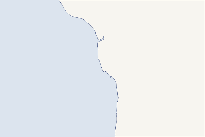
Port St. Joe & St. Joseph Bay at a glance
- Who permits it
- City of Port St. Joe inside city limits. Highland View and Oak Grove are Gulf County land.
- Call first
- Port St. Joe Building Department, (850) 229-1093
- The water
- St. Joseph Bay, a clear, salty lagoon and state aquatic preserve with small daily tides
- Local rule to know
- Inside the city, the first 50 feet inland from mean high water is a protection zone. On county land, new vertical seawalls are barred.
Get to know your waterfront
Port St. Joe sits on the northeast shore of St. Joseph Bay, a clear, salty lagoon that is also a state aquatic preserve. Inside city limits, the first 50 feet inland from the bay’s mean high water line is a protection zone. Highland View and Oak Grove are county land, where the comprehensive plan bars new vertical seawalls. Daily tides are small, so storm surge, not tide, is what tests a bay wall here.
St. Joseph Bay Aquatic Preserve · City of Port St. Joe Land Development Regulations (LDR-FINAL.pdf), Sec. 4.08 · GNIS Domestic Names, Florida (DomesticNames_FL.txt) · TIGERweb Places_CouSub_ConCity_SubMCD MapServer, layer 4 (Incorporated Places) and layer 5 (CDPs), point-intersect queries · Gulf County Comprehensive Plan (current adopted revisions as of 2/25/2020), Chapter 5 Coastal Management Element · NOAA CO-OPS station 8728912 datums
Settle city or county before anyone designs the wall
On St. Joseph Bay, the city line decides which shoreline rules govern your seawall or bulkhead. DEP lists Highland View as an unincorporated community, and Census maps put Highland View and Oak Grove outside Port St. Joe city limits. DEP community list Census place check Confirm your own parcel with the right office on our Gulf County permit guide before anyone draws a plan.
| Question | Inside Port St. Joe | Highland View or Oak Grove (county) |
|---|---|---|
Who issues the building permit? | City Building Department, staffed by EPCI at 1002 10th Street | Gulf County Building Department at the courthouse complex |
Is a new vertical seawall allowed? | The county ban does not apply, but the 50-foot bay zone limits work to water-dependent uses | Prohibited in coastal areas by comprehensive plan Policy 1.4.5 |
How far back from the bay? | 50 feet from mean high water (LDR Secs. 4.08 and 4.16) | 50 feet from the aquatic preserve boundary, with relief for lots deeded by 1992 |
Flood insurance CRS discount | None (Class 10) | 20% (Class 6) |
Table sources: City Building Department County Building Department County seawall policy City bay setback County bay buffer FEMA CRS classes
What the 50-foot bay zone means on a city lot
Port St. Joe treats the strip from the bay’s mean high water line (MHW, the average high-tide mark) to 50 feet inland as a shoreline protection zone. Only water-dependent work with a clear public benefit, or work under a permit for activity seaward of the zone, may happen there. LDR Sec. 4.08
Fixing a dock or seawall after a storm still counts as redevelopment that needs a city permit. The city also holds final approval until the state and federal permits are issued. Coastal policies 1.5.3 and 1.6.4
Gulf County’s coastal construction control line (CCCL, the line seaward of which DEP regulates beach and dune work) also follows parts of St. Joseph Bay. Rule 62B-26.016 If your survey puts the lot seaward of it, read the CCCL and armoring guide too.
Why a taller bay wall would not have saved the east-side homes
Michael pushed water to between +10.1 and +12.1 feet NAVD88 (the national survey datum for elevations) through town. Docks, roads and shoreline armoring at the public marina took major damage. DEP Michael report That marina had opened in 1999 with 109 wet slips. Aquatic preserve plan
The worst home flooding hit neighborhoods east of downtown, where many houses from the 1950s and 1960s were built on grade. DEP neighborhood observation Normal tides in the bay span only about 1.2 to 1.7 feet, so the threat to a bay wall is surge and waves. NOAA station 8728912
Takeaway: On a Port St. Joe bay lot, size the seawall for erosion and waves. Raising the house and its equipment is what answers a Michael-sized surge, so read the storm guide before paying for extra wall height.
Docks and walls inside the St. Joseph Bay Aquatic Preserve
The bay has been an aquatic preserve since 1970, and seagrass covers about one-sixth of its bottom. DEP preserve profile Preserve rules bar new seawalls out past the mean high water line. Restoring a seawall or riprap on its old line, or up to one foot out, is spared a separate consent-of-use application. Rule 18-20.004(1)(c) Rule 18-20.004(1)(e)7
- Private single-family dock walkway: no wider than 4 feet.
- Reach: no farther out than the point where water is 4 feet deep at mean low water (MLW).
- Terminal platform: 160 square feet at most.
- A nonconforming dock more than 50% destroyed by a storm must be rebuilt to current rules.
Dock rule sources: Rule 18-20.004(5) Nonconforming dock rule The 2019 coastal barrier maps also added areas on the east side of St. Joseph Bay to Unit P30, so check the FWS mapper before a rebuild. FWS Unit P30 remapping
Living shorelines have local backing on this bay
The preserve’s management plan says seawalls can scour the bottom and speed erosion next door. It supports a homeowner program that plants native smooth cordgrass, often behind a breakwater of bagged oyster shell or limestone. Aquatic preserve plan
State preserve rules even list converting a vertical bulkhead to riprap (loose rock armor) or plants as a public benefit. Rule 18-20.004(2)(d)4 Start with the living shoreline guide and the permit guide. Neighbors on the Gulf side face different rules at St. Joe Beach, Cape San Blas and Indian Pass.
What could the work cost?
Public records do not yet show a Port St. Joe seawall bid to compare against. Ask each bidder to list the seagrass survey, silt controls, any dock walkway rerouting and the state and federal permit work as separate lines. Preserve rules add steps that a canal job elsewhere may skip.
No public record found in Bay or Gulf County shows what a private homeowner paid per foot for a seawall. This guide shows real public bids, FEMA worksheets and fee schedules instead, each with its year, place and scope.
Compare quotes and plan a budget →Find the relevant permits and records
| Starting point | What to resolve | Prepare and look up |
|---|---|---|
Port St. Joe Building Department (EPCI) | Building permits for seawall, bulkhead and dock work inside city limits, including repairs after a storm. | Plot plan survey, two sets of signed plans, Notice of Commencement and any DEP or Corps approval. 1002 10th Street; (850) 229-1093. |
Gulf County Building Department | Permits for Highland View, Oak Grove and other unincorporated land on the bay. | Parcel number and every checklist item with an emailed application. Room 400, 1000 Cecil G. Costin, Sr. Blvd.; (850) 229-8944 ext. 1. An online CitizenServe portal is announced for November 9. |
DEP Northwest District, Panama City branch | State environmental permit or exemption, and consent to use state submerged lands in the aquatic preserve. | Proposed wall line against MHW, dock dimensions and a seagrass map. 2420 Jenks Ave., Suite 4-B, Panama City; (850) 872-4375. |
U.S. Army Corps of Engineers, Panama City Permits Section | Federal authorization for structures and fill in St. Joseph Bay. | The same drawings sent to the state. (850) 763-0717. |
A St. Joseph Bay shoreline checklist
Work through these steps before you ask for bids on a Port St. Joe seawall, bulkhead or dock.
Confirm which side of the city line you are on
Look up the parcel with the Gulf County Property Appraiser and ask the permit office whether it is inside Port St. Joe. Highland View and Oak Grove follow county rules.
Gulf County Property Appraiser · TIGERweb Places_CouSub_ConCity_SubMCD MapServer, layer 4 (Incorporated Places) and layer 5 (CDPs), point-intersect queries
Mark the 50-foot line on the survey
Have the surveyor show mean high water and a line 50 feet inland from it. Anything planned inside that strip needs a water-dependent purpose or a permit for work seaward of it.
City of Port St. Joe Land Development Regulations (LDR-FINAL.pdf), Sec. 4.08 · City of Port St. Joe Land Development Regulation Code, Secs. 4.06 and 4.16
Map the seagrass before drawing the dock
Pilings displace grass and decking shades it, so route the walkway around beds. Drone surveys counted 789 propeller scars in the bay in 2018-19.
St. Joseph Bay Aquatic Preserve Management Plan (Trustees approval Mar. 29, 2022)
Check the contractor’s city paperwork
Port St. Joe requires a state license, city registration and a city business license, even for out-of-state firms. City Hall at (850) 229-8261 can confirm the business license.
Port St. Joe - City Information · Starting a New Business / Business Licenses
Plan how equipment reaches the lot
Ask whether the crew will work from land or from the water. The Gulf County Canal links the bay to the Intracoastal Waterway, and Frank Pate Park has a four-lane public launch.
St. Joseph Bay Aquatic Preserve Management Plan (Trustees approval Mar. 29, 2022) · Frank Pate Park - City of Port St. Joe
Plan your Port St. Joe shoreline project
Tell us where the lot sits on the bay and what the wall or dock is doing. We will help you sort out the permits and find a qualified marine contractor.
Built on Bay and Gulf County permit rules, public records and storm data.
Port St. Joe & St. Joseph Bay project questions
Can I build a new vertical seawall in Highland View?
Gulf County’s comprehensive plan prohibits new vertical seawalls in coastal areas, with exceptions for bridges, port uses and commercial or industrial water-dependent uses. It encourages native plants and riprap instead. Ask County Planning how the policy treats your lot before paying for a design.
Do I need a city permit to fix storm damage to my seawall?
Yes. Port St. Joe treats repair or restoration of docks and seawalls after a disaster as redevelopment that needs development permits. It holds final approval until the other agency permits are issued.
City of Port St. Joe Comprehensive Plan - Adopted revisions to Coastal Management Element
Why does my flood insurance discount depend on the city line?
FEMA lists unincorporated Gulf County at CRS Class 6, worth 20% off NFIP policies. Port St. Joe is Class 10, which carries no discount. The parcel’s jurisdiction, not the mailing address, decides which applies.
How big can my dock be on St. Joseph Bay?
Preserve rules cap a private single-family dock walkway at 4 feet wide and the terminal platform at 160 square feet. The dock may not reach past the point where water is 4 feet deep at mean low water.
Rule 18-20.004(5) Standards and Criteria for Docking Facilities
Keep planning
Nearby waterfront guides
St. Joe Beach, Beacon Hill & WindMark, Cape San Blas & St. Joseph Peninsula, Indian Pass & Indian Lagoon
Show sourcesHide sources
- St. Joseph Bay Aquatic PreserveSource reviewed 2026-10-28
- City of Port St. Joe Land Development Regulations (LDR-FINAL.pdf), Sec. 4.08Source reviewed 2026-10-28
- GNIS Domestic Names, Florida (DomesticNames_FL.txt)Source reviewed 2026-10-28
- TIGERweb Places_CouSub_ConCity_SubMCD MapServer, layer 4 (Incorporated Places) and layer 5 (CDPs), point-intersect queriesSource reviewed 2026-10-28
- Gulf County Comprehensive Plan (current adopted revisions as of 2/25/2020), Chapter 5 Coastal Management ElementSource reviewed 2026-10-28
- NOAA CO-OPS station 8728912 datumsSource reviewed 2026-10-28
- St. Joseph Bay Aquatic Preserve Management Plan (Trustees approval Mar. 29, 2022)Source reviewed 2026-10-28
- Port St. Joe - City InformationSource reviewed 2026-10-28
- Building Department - Gulf County, FLSource reviewed 2026-10-28
- City of Port St. Joe Land Development Regulation Code, Secs. 4.06 and 4.16Source reviewed 2026-10-28
- Community Status Book Report: FloridaSource reviewed 2026-10-28
- City of Port St. Joe Comprehensive Plan - Adopted revisions to Coastal Management ElementSource reviewed 2026-10-28
- 62B-26.016 Description of the Gulf County Coastal Construction Control LineSource reviewed 2026-10-28
- Hurricane Michael Post-Storm Beach Conditions and Coastal Impact Report (April 2019)Source reviewed 2026-10-28
- Rule 18-20.004 Management Policies, Standards and CriteriaSource reviewed 2026-10-28
- Rule 18-20.004, F.A.C., Management Policies, Standards, and Criteria (aquatic preserves)Source reviewed 2026-10-28
- Unit P30, Cape San Blas, Florida - Summary of Final Recommended ChangesSource reviewed 2026-10-28
- Permit Requirements (EPCI, Port St. Joe)Source reviewed 2026-10-28
- Northwest District | Florida Department of Environmental ProtectionSource reviewed 2026-10-28
- Jacksonville District Regulatory Office LocationsSource reviewed 2026-10-28
- Gulf County Property AppraiserSource reviewed 2026-10-28
- Starting a New Business / Business LicensesSource reviewed 2026-10-28
- Frank Pate Park - City of Port St. JoeSource reviewed 2026-10-28