
Sandy Creek, Allanton and upper East Bay shoreline planning
Seawall plans in Sandy Creek and Allanton start with a county map layer. Bay County's Ecosystem Management Area rules name East Bay and keep a 30-foot natural strip at the water. On this shore, price a living shoreline next to the wall.
Describe your project on this page ↓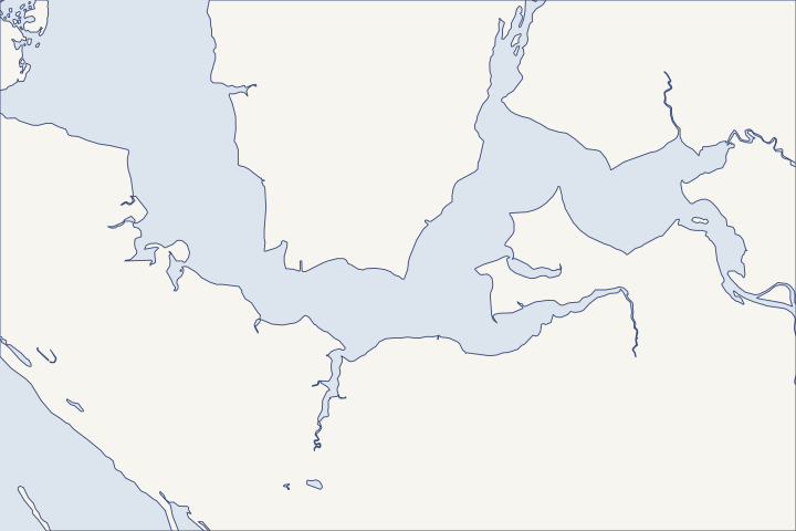
Sandy Creek, Allanton & East Bay at a glance
- Who permits it
- Bay County. Allanton and Sandy Creek are not among the county's seven cities.
- Call first
- Bay County Building Safety, (850) 248-8350
- The water
- Upper East Bay, about 18,700 acres fed by Sandy and Wetappo creeks and ten bayous
- Local rule to know
- In an Ecosystem Management Area, no building within 30 feet of mean high water, and the native strip stays in place.
Get to know your waterfront
This is the upper end of East Bay, an arm of St. Andrew Bay of about 18,700 acres fed by Sandy and Wetappo creeks and ten bayous. The Intracoastal Waterway enters East Bay through a cut in Wetappo Creek. Allanton and Sandy Creek are not among Bay County's seven cities, so county offices issue permits. Tyndall Air Force Base is a close neighbor, with its own reef work at Baker's Point.
St. Andrew Bay Surface Water Improvement and Management Plan (November 2017) · United States Coast Pilot 5, Chapter 12 (2026 edition) · GNIS Domestic Names - Florida (DomesticNames_FL.txt) · Community Status Book Report: Florida, Communities Participating in the National Flood Program (report date 10/28/2026) · New reef project at Tyndall AFB aims to protect against storms
Check the Ecosystem Management Area layer before drawing a wall
Bay County's Ecosystem Management Area (EMA) rules apply to East Bay. They limit what can sit near the water before any seawall or bulkhead design starts. LDR sec. 1905
- No building within 30 feet of mean high water (MHW, the average high-tide line) or the DEP wetland line.
- Piers and docks may cross that strip with one 10-foot cleared path.
- Native plants in the 30-foot strip stay.
- Stormwater is treated to Outstanding Florida Water standards, and septic systems sit at least 100 feet upland of the wetland line.
- No new sewage discharge points.
The comprehensive plan describes EMAs as undeveloped, unplatted rural or suburban land next to Class II waters, and it classes East Bay east of U.S. 98 as Class II. Comp plan Policy 6.7.4 Comp plan Policy 6.4.2 Ask Bay County Planning at (850) 248-8250 whether your parcel is inside the mapped area. Bay County Planning
A vertical wall, a sill or plants?
A living shoreline uses marsh plants, often behind a low rock or oyster sill set just offshore. NOAA describes these as options for sheltered bays and estuaries, not open beaches. NOAA guidance
| Option | State route | Federal route |
|---|---|---|
Native plantings, with or without a small breakwater | Exempt along 500 feet or less, reaching no more than 10 feet past MHW, if breakwater limits are met | Federal approval such as NWP 54 may still be needed |
Living shoreline with a reef or sill | DEP review; a living shoreline general permit is proposed but not adopted | NWP 54: up to 30 feet past mean low water and 500 feet along the bank |
Bulkhead, riprap or revetment | Exemption or permit, depending on location and scope | NWP 13: up to 500 feet; notice needed beyond that or where seagrass is touched |
Table sources: Rule 62-330.051(12)(e) Proposed Rule 62-330.604 NWP 54 NWP 13 The 2026 nationwide permits took effect March 15, 2026. USACE announcement The living shoreline guide and the permit guide cover each route.
Tyndall is testing reefs next door
On October 21, 2024, Tyndall began building a hybrid oyster reef of concrete modules and live oysters at Baker's Point. The Defense Department's Reefense program is spending $19.4 million across sites and aims to protect over 40 miles of base shoreline. Tyndall AFB
That work does not fund or regulate private lots. Bay County separately holds a $500,000 RESTORE Act award, dated December 2022, for an East Bay Living Shoreline and Seagrass Project. RESTORE Act award list
Price both options: ask for a living shoreline or sill quote alongside the vertical wall. In an EMA, a design that leaves the 30-foot native strip alone starts out consistent with the county rule.
Michael's water near the base
NHC estimated 6 to 9 feet of surge above ground near Tyndall in St. Andrew Sound. Every building on the base was reported damaged, about $3 billion of Florida's estimated $18.4 billion total. NHC Michael report
One of Florida's five surge drownings happened near East Bay on the eastern side of the Panama City area, and all five victims were in surge evacuation zones. NHC Michael report Treat a wall here as erosion control, raise equipment, and leave when told. The storm guide has the details.
Other overlays on this shore
- Tyndall's Air Installation Compatibility Use Zones are a county overlay. Development over 50 feet tall in certain sections goes to the base for review. LDR sec. 1003
- Sandy Creek State Forest, 12,262 acres of upland bought by the state on June 10, 2025, will be managed by the Florida Forest Service. DEP Florida Forever
- The Maude Holmes ramp on Sandy Creek Road is a county saltwater ramp where commercial use is allowed. Bay County ramp list
- A restricted drone launch corridor runs through St. Andrew Sound to the Gulf under 33 CFR 334.770. Coast Pilot 5
Closer to town, Callaway and Parker run city permit offices. To the east, Mexico Beach faces open Gulf surge. County-wide steps are in the Bay County guide.
What could the work cost?
Public records show no local seawall price for this stretch of East Bay. Ask each bidder to quote a living shoreline or sill next to the vertical wall, and to show how equipment reaches the lot without clearing the 30-foot native strip.
No public record found in Bay or Gulf County shows what a private homeowner paid per foot for a seawall. This guide shows real public bids, FEMA worksheets and fee schedules instead, each with its year, place and scope.
Compare quotes and plan a budget →Find the relevant permits and records
| Starting point | What to resolve | Prepare and look up |
|---|---|---|
Bay County Building Safety | Dock and seawall building permits for Allanton, Sandy Creek and other county lots. | Form B36 with engineered plans and a site plan showing setbacks. (850) 248-8350. |
Bay County Planning and Zoning | EMA status, the 30-foot strip, and clearing or fill permits. | Parcel number and a survey with the MHW line. (850) 248-8250; planning@baycountyfl.gov. |
DEP Northwest District | State exemption or permit, including the native plantings exemption for living shorelines. | Shoreline length, distance past MHW and any seagrass or marsh. Panama City branch: (850) 872-4375. |
U.S. Army Corps of Engineers, Panama City Permits Section | NWP 13 for a bulkhead or riprap, NWP 54 for a living shoreline. | Length along the bank and distance past mean low water. (850) 763-0717. |
Planning a shoreline on the marsh side of East Bay
Work through these before you commit to a wall, a sill or plants.
Look up the EMA layer
Ask Bay County Planning whether the parcel is in the East Bay Ecosystem Management Area and where the 30-foot line falls.
Bay County Land Development Regulations Chapter 19, Environmental Standards · Planning & Zoning | Bay County, FL
Map the marsh and seagrass
Have the surveyor mark mean high water, the wetland line and any seagrass. Under NWP 13, work that reaches seagrass needs federal notice first.
Reissuance and Modification of Nationwide Permits (full text), NWP 13
Ask for two designs
Have the designer sketch a living shoreline or sill and a vertical wall, with the permit route for each.
NOAA Fisheries: Understanding Living Shorelines · Reissuance and Modification of Nationwide Permits (full text), NWP 54
Check the base overlay
Ask Planning whether the lot falls inside Tyndall's compatibility zones before you plan any new structure.
Bay County Land Development Regulations Chapter 10, Special Treatment Zones
Know your evacuation zone
Michael's surge near Tyndall reached an estimated 6 to 9 feet. Look up your zone on the county map before storm season.
Tropical Cyclone Report: Hurricane Michael (AL142018) · Property Protection & Flood Hazards
Plan your East Bay shoreline
Tell us about the shoreline, the marsh in front of it and what is eroding. We will help you weigh a wall against softer options and find a qualified marine contractor.
Built on Bay and Gulf County permit rules, public records and storm data.
Sandy Creek, Allanton & East Bay project questions
Can I build a seawall inside the East Bay Ecosystem Management Area?
The EMA rule bars buildings within 30 feet of mean high water and keeps native plants in that strip, while allowing piers and docks with a 10-foot path. Ask Bay County Planning and DEP how a wall would be treated on your lot.
Bay County Land Development Regulations Chapter 19, Environmental Standards · Planning & Zoning | Bay County, FL
Is a living shoreline exempt from state permits?
Native plantings along 500 feet or less, reaching no more than 10 feet past mean high water, can be exempt if any breakwater meets the rule's limits. Federal approval may still be needed.
How high did Michael's water get near Allanton?
NHC estimated 6 to 9 feet above ground near Tyndall in St. Andrew Sound. It gave no separate reading for Allanton or Sandy Creek.
Does Tyndall's reef project protect my shoreline?
No. The Baker's Point reef is a federal project on base shoreline. It does not regulate or pay for private work.
New reef project at Tyndall AFB aims to protect against storms
Keep planning
Nearby waterfront guides
Show sourcesHide sources
- St. Andrew Bay Surface Water Improvement and Management Plan (November 2017)Source reviewed 2026-10-28
- United States Coast Pilot 5, Chapter 12 (2026 edition)Source reviewed 2026-10-28
- GNIS Domestic Names - Florida (DomesticNames_FL.txt)Source reviewed 2026-10-28
- Community Status Book Report: Florida, Communities Participating in the National Flood Program (report date 10/28/2026)Source reviewed 2026-10-28
- New reef project at Tyndall AFB aims to protect against stormsSource reviewed 2026-10-28
- Bay County Land Development Regulations Chapter 19, Environmental StandardsSource reviewed 2026-10-28
- Bay County Comprehensive Plan Chapter 6, Conservation ElementSource reviewed 2026-10-28
- Planning & Zoning | Bay County, FLSource reviewed 2026-10-28
- NOAA Fisheries: Understanding Living ShorelinesSource reviewed 2026-10-27
- 62-330.051 Exempt ActivitiesSource reviewed 2026-10-27
- Rule 62-330.604: General Permit for the Installation, Construction and Maintenance of Living ShorelinesSource reviewed 2026-10-27
- Reissuance and Modification of Nationwide Permits (full text), NWP 54Source reviewed 2026-10-27
- US Army Corps of Engineers announces publication of 2026 nationwide permitsSource reviewed 2026-10-23
- Direct Component Grant AwardsSource reviewed 2026-10-28
- Tropical Cyclone Report: Hurricane Michael (AL142018)Source reviewed 2026-10-28
- Bay County Land Development Regulations Chapter 10, Special Treatment ZonesSource reviewed 2026-10-28
- 2026 Florida Forever Plan: Bear Creek ForestSource reviewed 2026-10-28
- Boat Ramp LocationsSource reviewed 2026-10-28
- United States Coast Pilot 5, Chapter 6 (2026 edition)Source reviewed 2026-10-28
- Permits | Bay County, FLSource reviewed 2026-10-28
- Dock and Seawall Permit Packet (Forms B36, B03; B03 revised 09/30/2026)Source reviewed 2026-10-28
- Northwest District | Florida Department of Environmental ProtectionSource reviewed 2026-10-28
- Jacksonville District Regulatory Office LocationsSource reviewed 2026-10-28
- Property Protection & Flood HazardsSource reviewed 2026-10-28