
West Bay and Breakfast Point shoreline planning
West Bay seawall and dock projects usually start with marsh and seagrass rather than open water, and Breakfast Point Boulevard is split between the city and the county. Check both before a contractor draws a bulkhead.
Describe your project on this page ↓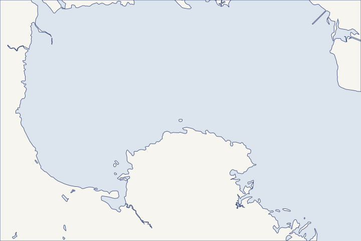
West Bay & Breakfast Point at a glance
- Who permits it
- Bay County on Burnt Mill Creek Road and West Bay Parkway. Breakfast Point Boulevard splits between the city and the county.
- Call first
- Bay County Building Safety, (850) 248-8350, or the city, (850) 233-5100 ext. 2601
- The water
- West Bay, the northwest arm of St. Andrew Bay, edged by salt marsh, oyster bars and seagrass
- Local rule to know
- About 14.4 of its 30 miles of shorefront would stay natural under conservation plans. Plan the dock across the marsh before the wall.
Get to know your waterfront
West Bay is the northwest arm of St. Andrew Bay, edged by salt marsh, oyster bars and seagrass and fed by Burnt Mill and Crooked creeks. About 14.4 of its 30 miles of shorefront would stay natural under conservation plans. Burnt Mill Creek Road and West Bay Parkway are unincorporated, while Breakfast Point Boulevard splits between Panama City Beach and the county. Plan a dock across marsh before you plan a wall.
U.S. Coast Pilot 5, Chapter 6 (pages dated 25 OCT 2026) · 2026 Florida Forever Plan: West Bay Preservation Area · Bay County GIS BayView Addresses layer 0 and AdministrativeAreas layer 0 (queries) · Bay County GIS BayView Addresses layer 0 (statistics query on ST_NAME LIKE '%BREAKFAST%')
Designing for marsh, seagrass and a split boulevard
On West Bay, the habitat in front of your lot decides more than the wall does. Map the marsh and seagrass first, then confirm which office holds your parcel.
Breakfast Point: one boulevard, two building offices
Bay County's address layer codes 94 points on Breakfast Point Boulevard to Panama City Beach and 73 to unincorporated Bay County. County address layer All addresses on Burnt Mill Creek Road, West Bay Parkway and West Bay Landing Lane are county. Street check Check your own parcel before you file, using the Bay County seawall guide.
Much of this shore is set aside
- The proposed West Bay Preservation Area covers 4,598 acres, with none acquired as of the 2026 state plan. It borders the 9,600-acre Panama City Airport Conservation Easement. Florida Forever plan
- The Breakfast Point Mitigation Bank instrument describes 5,031 acres owned by St. Joe on the peninsula, ringed by about 2,250 acres of conservation land. Mitigation bank instrument
- Together these lands would keep about 14.4 miles of West Bay shorefront in natural condition. Florida Forever plan
Seagrass and Class II water shape the design
Bay County's plan classifies most of West Bay as Class II water, with the creeks excluded. Comprehensive Plan Policy 6.4.2 The county keeps shorelines natural. No mowed grass is allowed within six feet of the water unless a seawall is there. Beside Class I and II water, a 30-foot natural buffer stays in place where one exists. LDR 2807
The county also bars development that damages seagrass unless no alternative exists. LDR 1904(2) A state survey in 2011 recorded a seagrass band about 100 feet wide between Burnt Mill and Crooked creeks. Florida Forever plan West Bay lost about 1,853 acres of seagrass between the 1950s and the early 1990s. SWIM plan
Under the state dock general permit, a walkway crossing seagrass must stand at least 5 feet above mean high water, and lifts and platforms cannot sit over it. Rule 62-330.427 The dock and lift guide explains the layout choices.
Which sector plan zone is your lot in?
Inside the Bay-Walton Sector Plan, the zone sets what can be built at the water. Ordinary platted lots elsewhere follow standard zoning. LDR 1609 LDR 1605
| Zone | Docks and ramps | Marinas |
|---|---|---|
West Bay Preservation Area | Allowed; a shared multi-slip dock if shown to be environmentally preferable | Not allowed, and no live-aboards |
West Bay Center | Water-dependent uses allowed | Allowed, with wet and dry slips |
Preservation land also bans turf grass, fertilizer, pesticides and herbicides. Comprehensive Plan Chapter 12
Bridges and oyster bars limit the boat
- The State Road 79 and Hathaway bridges each have 65 feet of vertical clearance, and nearby overhead cables are charted at 70 and 85 feet. Coast Pilot
- Several oyster bars in West Bay have only 5 to 8 feet of water over them. Coast Pilot
Size the lift and dock for the boat that can actually get out, and give the marine contractor a current chart for the barge route.
Planted shorelines have a clear permit path
State rules exempt planting native marsh along 500 feet or less of eroding shore, reaching no more than 10 feet out past the mean high water line. A low breakwater of shell or rock may be added if it stays 3 feet from seagrass or marsh. Rule 62-330.051(12)(e) Federal Nationwide Permit 54 covers living shorelines in low-energy water. NWP 54 Compare the options in the living shoreline guide and the riprap guide.
Design from the water side in: marsh and seagrass first, zone second, wall last. For the lake and Gulf lots to the southwest, see Laguna Beach and Lake Powell. The permit guide explains how the state and federal reviews fit together.
What could the work cost?
On West Bay, what sits in front of the lot drives the budget. A dock that crosses marsh or seagrass needs a longer, higher walkway. A planted shoreline may replace part of a wall, so ask bidders to price both a wall and a softer, planted option.
No public record found in Bay or Gulf County shows what a private homeowner paid per foot for a seawall. This guide shows real public bids, FEMA worksheets and fee schedules instead, each with its year, place and scope.
Compare quotes and plan a budget →Find the relevant permits and records
| Starting point | What to resolve | Prepare and look up |
|---|---|---|
Bay County Building Safety Division | County lots, including Burnt Mill Creek Road and West Bay Parkway. | Engineered dock or seawall drawings and a site plan. (850) 248-8350. |
City of Panama City Beach Building Department | City lots on the Breakfast Point side. | Parcel record showing Tax Area 13. The city's reference sheet lists (850) 233-5100 ext. 2601. |
Bay County Planning and Zoning | Sector plan zones, the West Bay Detailed Specific Area Plan and shoreline buffers. | Zone name and a site plan with the marsh line. (850) 248-8250. |
DEP Northwest District and the Corps Panama City Permits Section | Seagrass, marsh and dock reviews. The West Bay regional Corps permit does not cover seawalls or docks in navigable water. | Habitat survey and plans. DEP Panama City branch (850) 872-4375; Corps (850) 763-0717. |
West Bay dock and shoreline checklist
These steps help you describe the lot the way reviewers will look at it.
Map the habitat in front of the lot
Mark marsh, seagrass and oyster bars on the survey. Seagrass limits where a lift, platform or walkway can go.
2026 Florida Forever Plan: West Bay Preservation Area · 62-330.427 General Permit for Docks, Piers and Associated Structures
Name your zone
Ask Planning whether the lot sits in the West Bay Preservation Area, West Bay Center or ordinary zoning. Marinas and shared docks turn on that answer.
Bay County Land Development Regulations, Chapter 16 Bay-Walton Sector Plan Zones
Look for an existing elevation certificate
Panama City Beach keeps elevation certificates for listed homes, mostly in Breakfast Point, Tierra Verde Phase III and Seagrass Village. Bay County posts county-held certificates from 2007 on.
Flood Zone & Community Rating System Information · Elevation Certificates
Match the lift to the route out
Check mast height against the 65-foot bridges and draft against the oyster bars before you order a lift.
U.S. Coast Pilot 5, Chapter 12 (pages dated 25 OCT 2026) · U.S. Coast Pilot 5, Chapter 6 (pages dated 25 OCT 2026)
Plan your West Bay shoreline project
Tell us about the marsh or bank in front of your lot, the boat you keep and the work you have in mind. We will help you weigh dock, wall and planted options and find a contractor who knows West Bay.
Built on Bay and Gulf County permit rules, public records and storm data.
West Bay & Breakfast Point project questions
Does the Corps regional permit for West Bay cover my seawall?
No. RGP SAJ-86 authorizes fill in non-navigable waters for development projects. Seawalls and docks on West Bay need their own federal authorization.
Can our HOA build one shared dock instead of several?
In the West Bay Preservation Area zone, a common multi-slip dock is allowed if you show the Planning and Zoning Manager it is environmentally better than separate docks.
Bay County Land Development Regulations, Chapter 16 Bay-Walton Sector Plan Zones
Can I mow my lawn down to the water?
Not within six feet of the water's edge, unless a seawall or bulkhead is there or the grass is needed for erosion control. Beside Class II water such as West Bay, a 30-foot natural buffer must also stay where one exists.
Bay County Land Development Regulations, Chapter 28 Landscaping and Buffers · Bay County Comprehensive Plan Chapter 6, Conservation Element
Where are the public ramps on West Bay?
Bay County lists ramps at B.V. Buchanan Park by the State Road 79 bridge, on Burnt Mill Creek Road and at Crooked Creek on Titi Road, plus the West Hathaway Bridge ramp.
Keep planning
Nearby waterfront guides
Laguna Beach, Sunnyside & Lake Powell, Gulf-front Panama City Beach, Lynn Haven & North Bay
Show sourcesHide sources
- U.S. Coast Pilot 5, Chapter 6 (pages dated 25 OCT 2026)Source reviewed 2026-10-28
- 2026 Florida Forever Plan: West Bay Preservation AreaSource reviewed 2026-10-28
- Bay County GIS BayView Addresses layer 0 and AdministrativeAreas layer 0 (queries)Source reviewed 2026-10-28
- Federal Mitigation Bank Instrument / FDEP Mitigation Bank Permit, Breakfast Point Mitigation Bank (Appendix A)Source reviewed 2026-10-28
- Bay County Comprehensive Plan Chapter 6, Conservation ElementSource reviewed 2026-10-28
- Bay County Land Development Regulations, Chapter 28 Landscaping and BuffersSource reviewed 2026-10-28
- Bay County Land Development Regulations, Section 1904Source reviewed 2026-10-28
- St. Andrew Bay Surface Water Improvement and Management (SWIM) Plan, November 2017Source reviewed 2026-10-28
- 62-330.427 General Permit for Docks, Piers and Associated StructuresSource reviewed 2026-10-27
- Bay County Land Development Regulations, Chapter 16 Bay-Walton Sector Plan ZonesSource reviewed 2026-10-28
- Bay County Comprehensive Plan, Chapter 12 Bay-Walton Sector Plan ElementSource reviewed 2026-10-28
- U.S. Coast Pilot 5, Chapter 12 (pages dated 25 OCT 2026)Source reviewed 2026-10-28
- 62-330.051 Exempt ActivitiesSource reviewed 2026-10-27
- Reissuance and Modification of Nationwide Permits (full text), NWP 54Source reviewed 2026-10-27
- Permits | Bay County, FLSource reviewed 2026-10-28
- Building Departments (reference list)Source reviewed 2026-10-28
- Building | Panama City Beach, FLSource reviewed 2026-10-28
- Comprehensive PlanningSource reviewed 2026-10-28
- Northwest District | Florida Department of Environmental ProtectionSource reviewed 2026-10-28
- Jacksonville District Regulatory Office LocationsSource reviewed 2026-10-28
- Department of the Army Regional General Permit SAJ-86 (SAJ-2004-01861), Choctawhatchee Bay, Lake Powell and West Bay BasinsSource reviewed 2026-10-28
- Flood Zone & Community Rating System InformationSource reviewed 2026-10-28
- Elevation CertificatesSource reviewed 2026-10-28
- Boat Ramp LocationsSource reviewed 2026-10-28