
Laguna Beach and Lake Powell seawall planning
Laguna Beach and Lake Powell seawall work is a Bay County matter, because the streets checked here are unincorporated despite Panama City Beach mail. The lake and the Gulf beach then bring two very different rulebooks.
Describe your project on this page ↓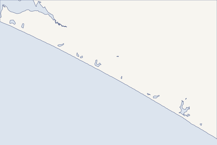
Laguna Beach, Sunnyside & Lake Powell at a glance
- Who permits it
- Bay County. The west-end Gulf condos and the Lake Powell streets are unincorporated, whatever the envelope says.
- Call first
- Bay County Building Safety, (850) 248-8350
- The water
- The Gulf, plus Lake Powell, a coastal dune lake that rises with rain and drops when Phillips Inlet is opened
- Local rule to know
- Lake Powell is an Outstanding Florida Water, so state review of lake work is stricter.
Get to know your waterfront
The west end has two shorelines. On the Gulf side, Pinnacle Port, Carillon and Ramsgate front a renourished beach in unincorporated Bay County. Inland, Lake Powell is a coastal dune lake and an Outstanding Florida Water, the state's top water-quality class. Its level is managed by digging open Phillips Inlet when the lake runs high, so lakefront walls answer to rain and inlet openings rather than daily tides.
Bay County Land Development Regulations, Chapter 19 Environmental Standards · Bay County GIS AdministrativeAreas layer 0 and BayView Addresses layer 0 (queries) · Camp Helen State Park Approved Unit Management Plan · Rule 62-302.700(9)(i) Special Waters
Lake lot or beach lot: what to check first
Start with the county, then split by shoreline. Lake Powell lots carry water-quality and density limits, while west-end Gulf lots carry dune and control-line rules.
These streets are county, whatever the envelope says
Bay County's map returns unincorporated at the Laguna Beach and Sunnyside points. Every address on these streets is coded unincorporated. County jurisdiction check
- Carillon Avenue, Carillon Circle and Carillon Market Street
- Lake Powell Drive
- Laguna Street
- Sunnyside Lane
- Twin Lakes Drive
On Front Beach Road west of the city strip, 1,273 address points are county and 593 are city, so check each lot. Front Beach Road counts The Bay County guide shows how to read the tax district.
Lake Powell rises with rain, not tide
Phillips Inlet is usually plugged with sand, and lakefront homes would flood before the lake broke out on its own. A maximum level is set under a permit, and Bay County Public Works digs a starter channel when the gauge reaches it. The 2014 park plan counted about six openings a year on average. Camp Helen management plan
The outlet was opened again on May 26, 2026. DEP 2026 beach plan Before you set a wall, dock or floor height, ask the county how close your lot sits to the level that triggers an opening.
What Outstanding Florida Water status changes
Lake Powell, Phillips Inlet and every tributary to the lake have been an Outstanding Florida Water (OFW) since 1991. Rule 62-302.700 Work in an OFW must be shown to be clearly in the public interest, a higher bar than elsewhere. Section 373.414(1) The table gathers the limits from state law and the county and city codes. Dock exemption LDR 1912 City marina rule
| Topic | Lake Powell limit |
|---|---|
Permit-exempt private dock | 500 sq ft or less over the water (1,000 sq ft elsewhere) |
Septic tanks and drainfields | None in the first 100 ft of shoreline |
County land within 200 ft | Up to 2 homes per acre, single-family only, 60% pervious, 25% native vegetation |
Marinas, city side | Not allowed in the lake or its protection zone |
The county's lake rule does not speak to seawalls directly. County Lake Powell rule Ask DEP early whether a vertical wall, a planted edge or a living shoreline fits your bank, and size any dock with the dock and lift guide in hand.
West-end Gulf lots: dunes come first
On unincorporated beachfront, Bay County requires builders to avoid dune damage and restore any significant dune they disturb. New beachfront projects need walkovers about three feet above the sand, footprints as far inland as possible, and nothing that adds to erosion of another property. LDR 1904(8) Development seaward of the control line must meet the state coastal rule, and development within 1,500 feet of it must meet the Coastal Zone Protection Act. Comprehensive Plan Policy 7.4.3
Pinnacle Port and Carillon Beach sit in the federal fill reach authorized until 2061. Project authorization They received trucked sand in 2006, an initial federal restoration of about 453,000 cubic yards in 2011, and about 157,000 cubic yards in 2017. DEP fill history
How storms treated the west end
DEP found Michael's damage sporadic near the Walton line, more common about five miles in and widespread about ten miles from the county line. DEP Michael report In 1995, Opal overwashed a large expanse of the Camp Helen dunes, which were still slowly reforming years later. Camp Helen plan
West-end rule of thumb: on the lake, plan around water quality and inlet-driven high water; on the Gulf, plan around the dune and the state line. For the open strip to the east, see Gulf-front Panama City Beach. For the bay north of the Intracoastal, see West Bay and Breakfast Point. The permit guide covers the state steps.
What could the work cost?
On Lake Powell, set money aside for environmental review and possibly a planted shoreline, not only for a wall. On the Gulf side, a quote that includes dune restoration and a walkover will sit closer to the real total than one that prices the structure alone.
No public record found in Bay or Gulf County shows what a private homeowner paid per foot for a seawall. This guide shows real public bids, FEMA worksheets and fee schedules instead, each with its year, place and scope.
Compare quotes and plan a budget →Find the relevant permits and records
| Starting point | What to resolve | Prepare and look up |
|---|---|---|
Bay County Building Safety Division | Building permit for any new dock or seawall and any structural repair on county lots. | Engineered drawings and a site plan, filed with the office at 840 W 11th Street. (850) 248-8350. |
Bay County Planning and Zoning | Lake Powell overlay, the 30-foot shoreline setback and dune rules. | Survey showing the distance to the lake shoreline and any dune. (850) 248-8250. |
DEP Northwest District, Panama City Branch | State exemption or permit for lake work, with the OFW public-interest test. | Plans showing the shoreline, any plantings and the dock area. (850) 872-4375. |
DEP Coastal Construction Control Line Program | Gulf-side work seaward of the 1997 control line. | Sealed survey and plans with Form 73-100. (850) 245-8570. |
West-end lot checklist
Use these steps to sort a Laguna Beach, Sunnyside or Lake Powell lot before you call a contractor.
Confirm the jurisdiction
Check the Property Appraiser record. Only city parcels show Tax Area 13, and the lake streets checked for this guide were all county.
Building | Panama City Beach, FL · Bay County GIS AdministrativeAreas layer 0 and BayView Addresses layer 0 (queries)
Measure from the lake's edge
Mark 100 feet and 200 feet from the Lake Powell shoreline on your survey. Septic, density and pervious-area limits change at those lines.
Bay County Land Development Regulations, Section 1912 Outstanding Florida Waters
Ask about high-water history
Ask Bay County Public Works how often the inlet has been opened and what lake level triggers it. Compare that level with your lowest floor and yard.
Camp Helen State Park Approved Unit Management Plan · Strategic Beach Management Plan: Panhandle Gulf Coast Region (August 2026)
Check the dune and walkover plan
For a Gulf lot, show the dune line and a walkover about three feet above the sand. Keep the footprint as far inland as the lot allows.
Bay County Land Development Regulations, Section 1904(8) · Bay County Land Development Regulations, Chapter 19 Environmental Standards
Share your Laguna Beach or Lake Powell project
Tell us whether the lot faces the lake or the Gulf, what the bank or wall looks like and what you hope to build. We will help you plan the permits and find a contractor familiar with the west end.
Built on Bay and Gulf County permit rules, public records and storm data.
Laguna Beach, Sunnyside & Lake Powell project questions
Why does Lake Powell flood without a storm surge?
The inlet to the Gulf is usually closed by sand, so rain fills the lake until the county digs a channel. Lake levels and rainfall are watched to decide when to open it.
Camp Helen State Park Approved Unit Management Plan · Strategic Beach Management Plan: Panhandle Gulf Coast Region (August 2026)
Is a Lake Powell dock exempt from a state permit?
Possibly, if it is small. In an Outstanding Florida Water the private dock exemption tops out at 500 square feet over the water, half the limit elsewhere. County and federal approvals still apply.
2026 Florida Statutes s. 403.813 Permits issued at district centers; exceptions · Rule 62-302.700(9)(i) Special Waters
Does the Corps regional permit set a lake buffer?
Regional General Permit SAJ-86 requires a 30-foot buffer from Lake Powell's ordinary high water line in Bay County. It mainly covers fill for larger development, not every homeowner's dock or wall.
Is there a 30-foot setback from the water on county lots?
In most cases, yes. Buildings must stay 30 feet from the high water line or DEP's wetland boundary line, except where seawalls or bulkheads already exist. Docks and a 10-foot access path are allowed.
Bay County Land Development Regulations, Chapter 19 Environmental Standards
Keep planning
Nearby waterfront guides
Gulf-front Panama City Beach, West Bay & Breakfast Point, Grand Lagoon, Thomas Drive & Bay Point
Show sourcesHide sources
- Bay County Land Development Regulations, Chapter 19 Environmental StandardsSource reviewed 2026-10-28
- Bay County GIS AdministrativeAreas layer 0 and BayView Addresses layer 0 (queries)Source reviewed 2026-10-28
- Camp Helen State Park Approved Unit Management PlanSource reviewed 2026-10-28
- Rule 62-302.700(9)(i) Special WatersSource reviewed 2026-10-28
- BayView map service - Addresses layer (CITY and CMNTY fields)Source reviewed 2026-10-28
- Strategic Beach Management Plan: Panhandle Gulf Coast Region (August 2026)Source reviewed 2026-10-28
- Florida Statutes s. 373.414 (2026 Florida Statutes)Source reviewed 2026-10-27
- 2026 Florida Statutes s. 403.813 Permits issued at district centers; exceptionsSource reviewed 2026-10-27
- Bay County Land Development Regulations, Section 1912 Outstanding Florida WatersSource reviewed 2026-10-28
- Land Development Code, Panama City Beach, Section 5.06.11 MarinasSource reviewed 2026-10-28
- Bay County Comprehensive Plan, Chapter 7 Coastal Management ElementSource reviewed 2026-10-28
- Hurricane Michael Post-Storm Beach Conditions and Coastal Impact Report (April 2019)Source reviewed 2026-10-28
- Permits | Bay County, FLSource reviewed 2026-10-28
- Planning & Zoning | Bay County, FLSource reviewed 2026-10-28
- Northwest District | Florida Department of Environmental ProtectionSource reviewed 2026-10-28
- DEP Coastal Construction Control Line ProgramSource reviewed 2026-10-27
- 62B-26.024 Description of the Bay County Coastal Construction Control Line (rule text, notice 2330733)Source reviewed 2026-10-28
- CCCL Permit Application GuidelinesSource reviewed 2026-10-27
- Building | Panama City Beach, FLSource reviewed 2026-10-28
- Department of the Army Regional General Permit SAJ-86 (SAJ-2004-01861), Choctawhatchee Bay, Lake Powell and West Bay BasinsSource reviewed 2026-10-28