
Cape San Blas seawall and erosion planning
On Cape San Blas and St. Joseph Peninsula, a private seawall is the exception: Gulf County allows armoring only where agencies permit it for emergency protection in the critical erosion stretch. Public beach fill and new breakwaters carry most of the load.
Describe your project on this page ↓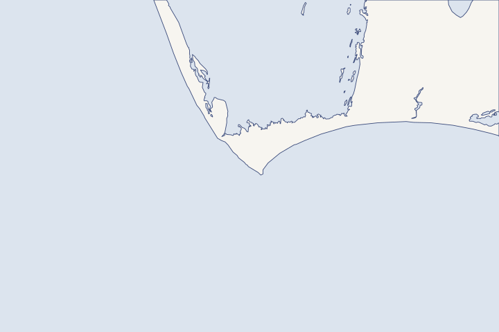
Cape San Blas & St. Joseph Peninsula at a glance
- Who permits it
- DEP's CCCL program for Gulf-front work, then Gulf County
- Call first
- Gulf County Planning, (850) 227-9562
- The water
- A 17-mile barrier spit between the Gulf and St. Joseph Bay. The cape's west shore has lost about 40 feet a year on average.
- Local rule to know
- Emergency permits after a storm cannot be used for new permanent armoring.
Get to know your waterfront
St. Joseph Peninsula is a 17-mile barrier spit with the Gulf on its west side and St. Joseph Bay on its east. Erosion peaks near Stump Hole, and the cape’s west shore has lost about 40 feet a year on average. Bay-side lots are exposed too, because Michael’s surge crossed the isthmus from the bay. Check the federal coastal barrier map before you budget a rebuild.
Hurricane Michael Post-Storm Beach Conditions and Coastal Impact Report (April 2019) · Unit P30, Cape San Blas, Florida - Summary of Final Recommended Changes
Know which stretch of the peninsula you are on
The peninsula behaves differently by stretch, so the right question depends on where your lot sits. DEP describes sand moving north along the spit, with erosion peaking to the south at Stump Hole, a drift divide (a point where sand drifts away in both directions). DEP peninsula description
DEP rates the cape’s west shore as the fastest-eroding on Florida’s Gulf coast, about 40 feet a year. Over 40 years, Eglin buildings and the lighthouse complex gulfward of County Road 30E were lost or moved. DEP erosion rate The lighthouse now stands in George Core Park in Port St. Joe. Lighthouse relocation
| Year | Project | Where (DEP monuments) |
|---|---|---|
2009 | Beach nourishment, about 3.6 million cubic yards | R67 to R105.5 |
2012-13 | 1,550-foot boulder mound protecting County Road 30E | R105 to R107 (Stump Hole) |
2016 | 800 feet of armoring for threatened homes | Within R-90 to R-105.5 |
2019 | Renourishment, 2.6 million cubic yards | R70.5 to R105.5, skipping Rish Park |
2021 | Upland-sand dune project, 79,000 cubic yards | South end |
2026 | About 853,000 cubic yards of sand, dune plantings and eight submerged breakwaters | R100 to R105.8 |
Table sources: Nourishment record Boulder mound 2016 armoring 2025 permit and 2026 work
What Stump Hole teaches about one-lot walls
County Road 30E at Stump Hole has been under attack since Hurricane Opal destroyed a segment of it in 1995. A rock mound built afterward was overtopped in 1998 and damaged again in 2004 and 2005. DEP beach management plan
The county’s engineered boulder mound largely protected the road in Michael. Its ends were the weak point: 900 feet of road washed out north of it and 300 feet south. DEP Michael findings
Takeaway: A hard structure shifts erosion to its ends, a failure engineers call flanking. A wall on one peninsula lot invites the same scour at your property line or your neighbor’s.
When Gulf County allows armoring at all
Gulf County’s plan bars new vertical seawalls in coastal areas. Policy 1.4.5 The one exception is the critical erosion area from the Eglin AFB property to the end of the developed state park. There, the limit lifts only if regulators permit a wall as necessary for emergency property protection. Objective 1.9
Even in that stretch, the plan says the county does not endorse seawalls and favors beach restoration. Critical erosion objective At the state level, emergency permits cannot be used for new permanent armoring, and temporary measures must come out within 60 days unless a permanent application is filed. DEP CCCL guidelines Emergency rule timelines
- Critically eroded: St. Joseph Peninsula from R69 to R106, about 7.2 miles. DEP critically eroded list
- Critically eroded: Cape San Blas from R106 to R111.5, a 1.1-mile segment that includes Stump Hole. DEP beach management plan
- Not critical: the northern state park segment from R41 to R69. DEP critically eroded list
The Gulf-front armoring guide lays out DEP’s eligibility test, and the Gulf County guide covers the county offices.
The 2026 breakwaters and who pays for them
DEP modified the project permit in October 2025 for submerged breakwaters near R102 to R105. Sand placement and dune planting wrapped up in May 2026, and the eight breakwaters were finished that August. DEP project record County bid notices also called for about 118,000 native dune plants. County bid scope
- Cape San Blas voters approved a taxing unit (MSTU) on April 12, 2016 to fund about $4 million of the beach restoration. Gulf County RESTORE plan
- A 1% tourist development tax for beach restoration was expected to raise about $265,000 a year. Gulf County RESTORE plan
- Treasury lists a $2.8 million RESTORE award for peninsula beach restoration dated November 14, 2018. RESTORE award list
- NFWF lists a grant of nearly $5 million for a peninsula dune habitat project. NFWF grants library
How the breakwaters perform over time is not yet known. Keep your own dune and walkover in shape rather than relying on the public project alone.
Check the coastal barrier map before you rebuild
Cape San Blas lies in Coastal Barrier Resources System (CBRS) Unit P30. Revised maps adopted by Congress in 2019 removed about 40 structures in the Cape Breezes subdivision. FWS Unit P30 record
In a CBRS unit, NFIP coverage is available only for buildings built or permitted before the area’s prohibition date. Damage or improvement above 50% of market value can end renewal of that federal policy. FWS flood insurance rule Read the insurance guide, then look up your parcel on the FWS CBRS Mapper.
Bay-side lots take surge from St. Joseph Bay
USGS marks on the isthmus to Cape San Blas reached +10.9 to +11.7 feet NAVD88 (the survey datum) in Michael. DEP traces them to water piling up at the south end of the bay and spilling across, as it did in Hurricane Kate in 1985. USGS and DEP marks Along that isthmus, 21 major structures took major damage. DEP damage counts
The bay side is part of the St. Joseph Bay Aquatic Preserve, so a planted marsh edge with a low rock or shell sill usually fits better than a new bulkhead. DEP preserve profile Compare options in the living shoreline guide, the permit guide and the neighboring Indian Pass and St. Joe Beach pages.
What could the work cost?
Public records show what the beach projects cost the county, not what one owner pays for a dune or wall. Ask for separate prices for dune plants, sand fencing, walkover repair and any engineering needed to show DEP a building is at risk. Also ask how turtle nesting season affects the schedule.
No public record found in Bay or Gulf County shows what a private homeowner paid per foot for a seawall. This guide shows real public bids, FEMA worksheets and fee schedules instead, each with its year, place and scope.
Compare quotes and plan a budget →Find the relevant permits and records
| Starting point | What to resolve | Prepare and look up |
|---|---|---|
DEP Coastal Construction Control Line program | Gulf-front armoring, dune work and building seaward of the CCCL, plus emergency authorizations after a storm. | Sealed survey and plans, with construction plans for any armoring. Emergency permits do not allow new permanent armoring. (850) 245-8570. |
Gulf County Planning Department | Whether your lot falls in the Objective 1.9 critical erosion area and how the seawall policy applies. | Parcel ID, DEP monument range if known and a written question. Review board applications are due before the 15th of the month. (850) 227-9562. |
Gulf County Building Department | County building permit for peninsula work once state approval is in hand. | Room 400, 1000 Cecil G. Costin, Sr. Blvd., Port St. Joe; (850) 229-8944 ext. 1. The county has announced a CitizenServe permit portal for November 9. |
DEP Northwest District, Panama City branch | Bay-side docks, living shorelines and other work in St. Joseph Bay Aquatic Preserve. | Shoreline sketch with marsh and seagrass marked. (850) 872-4375. |
A peninsula owner’s planning checklist
These steps sort out public projects, federal limits and your own lot before you talk to a contractor.
Find your DEP monument range
Projects and erosion ratings here are described by R-monuments. The critically eroded stretch runs R69 to R106 on the peninsula and R106 to R111.5 at Cape San Blas.
Critically Eroded Beaches in Florida (June 2026) · Strategic Beach Management Plan: Panhandle Gulf Coast Region (August 2026)
Check CBRS status on the FWS mapper
Unit P30 status decides whether federal flood insurance is available after a rebuild. Cape Breezes left the unit with the 2019 maps.
Unit P30, Cape San Blas, Florida - Summary of Final Recommended Changes · Federal Flood Insurance and CBRA
Plan around nesting and habitat seasons
Marine turtle nesting season runs May 1 to October 31. Piping plover critical habitat and beach mouse areas can add permit conditions, and work near the preserve faces stricter water-quality standards.
Strategic Beach Management Plan: Panhandle Gulf Coast Region (August 2026)
Document the dune each spring
Surf from Tropical Storm Bertha in July 2026 washed away beach stairs and fencing on North Cape San Blas. Dated photos help with permit and insurance questions after the next storm.
Post Tropical Cyclone Report: Tropical Storm Bertha (NWS Tallahassee)
Plan your Cape San Blas project
Say which side of the peninsula you are on and how the dune or wall looks today. We can help you line up the right questions and a qualified contractor.
Built on Bay and Gulf County permit rules, public records and storm data.
Cape San Blas & St. Joseph Peninsula project questions
Can I armor my Gulf-front lot on Cape San Blas?
Only in narrow cases. Gulf County lifts its vertical seawall limit in the critical erosion area only where regulators permit a wall for emergency protection. DEP also applies its own test of whether the building qualifies and is at risk.
Gulf County Comprehensive Plan, Coastal Management Element Objective 1.9 / Policies 1.9.x · 62B-33.0051 Coastal Armoring and Related Structures (with definitions in 62B-33.002)
Did Michael cut through the peninsula?
Yes. It breached St. Joseph Peninsula at Eagle Harbor between R71 and R72, scouring a channel about 200 feet wide. DEP says the breach closed on its own in May 2019.
Hurricane Michael Post-Storm Beach Conditions and Coastal Impact Report (April 2019)
How much damage did Michael do on the peninsula?
DEP counted 279 major structures with major damage, including 22 destroyed, on the developed peninsula from R67 to Stump Hole. Another 64 had damage beneath their raised floors.
Hurricane Michael Post-Storm Beach Conditions and Coastal Impact Report (April 2019)
Am I paying for the beach project?
Cape San Blas residents voted in 2016 for a taxing unit to fund part of the peninsula beach restoration. Check your tax bill or ask the county for the current rate.
RESTORE Act Direct Component Multiyear Plan - Gulf County, FL (February 2017)
Keep planning
Nearby waterfront guides
Indian Pass & Indian Lagoon, Port St. Joe & St. Joseph Bay, St. Joe Beach, Beacon Hill & WindMark
Show sourcesHide sources
- Hurricane Michael Post-Storm Beach Conditions and Coastal Impact Report (April 2019)Source reviewed 2026-10-28
- Unit P30, Cape San Blas, Florida - Summary of Final Recommended ChangesSource reviewed 2026-10-28
- Strategic Beach Management Plan: Panhandle Gulf Coast Region (August 2026)Source reviewed 2026-10-28
- Gulf County Comprehensive Plan (current adopted revisions as of 2/25/2020), Chapter 5 Coastal Management ElementSource reviewed 2026-10-28
- CCCL Permit Application GuidelinesSource reviewed 2026-10-27
- Guidance to Local Governments for Emergency Temporary Coastal Armoring and Other Emergency Measures Seaward of the Coastal Construction Control Line (March 2022)Source reviewed 2026-10-27
- Critically Eroded Beaches in Florida (June 2026)Source reviewed 2026-10-28
- Gulf County Bids page (Notice to Receive Sealed Bids, St. Joseph Peninsula Beach Renourishment and Coastal Structures Project)Source reviewed 2026-10-28
- RESTORE Act Direct Component Multiyear Plan - Gulf County, FL (February 2017)Source reviewed 2026-10-28
- Direct Component Grant AwardsSource reviewed 2026-10-28
- NFWF Grant Profile: St. Joseph Peninsula Dune Habitat Enhancement Project (FL)Source reviewed 2026-10-28
- Federal Flood Insurance and CBRASource reviewed 2026-10-28
- St. Joseph Bay Aquatic PreserveSource reviewed 2026-10-28
- DEP Coastal Construction Control Line ProgramSource reviewed 2026-10-27
- Planning & Development - Gulf County, FLSource reviewed 2026-10-28
- Building Department - Gulf County, FLSource reviewed 2026-10-28
- Northwest District | Florida Department of Environmental ProtectionSource reviewed 2026-10-28
- Post Tropical Cyclone Report: Tropical Storm Bertha (NWS Tallahassee)Source reviewed 2026-10-28
- 62B-33.0051 Coastal Armoring and Related Structures (with definitions in 62B-33.002)Source reviewed 2026-10-27