
St. Joe Beach seawall and dune planning
Seawall questions at St. Joe Beach, Beacon Hill and WindMark are Gulf-front questions: the state control line, a county policy against new vertical walls and a dune that owners keep up themselves.
Describe your project on this page ↓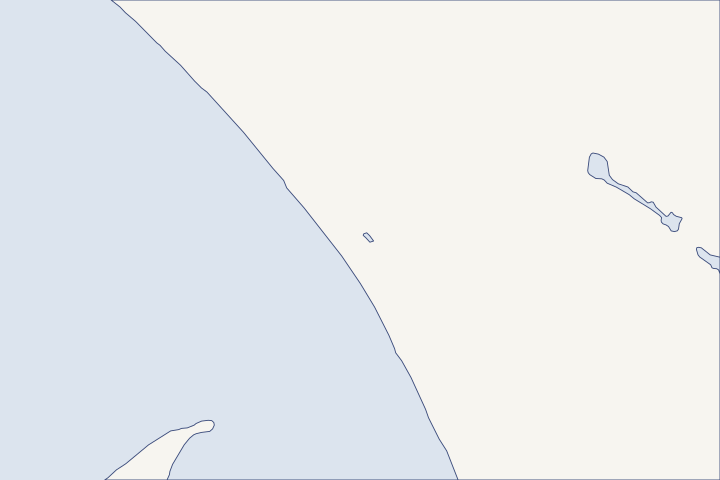
St. Joe Beach, Beacon Hill & WindMark at a glance
- Who permits it
- DEP's CCCL program first, then Gulf County
- Call first
- DEP CCCL program, (850) 245-8570
- The water
- The Gulf. Michael's water reached +21.2 feet NAVD88 at the west end of Beacon Hill.
- Local rule to know
- Gulf County's plan prohibits new vertical seawalls in coastal areas outside port, bridge and commercial or industrial water-dependent uses.
Get to know your waterfront
St. Joe Beach, Beacon Hill and WindMark line the Gulf-front mainland of Gulf County east of the Bay County line. Exposure changes fast along this shore. Michael’s water reached +21.2 feet NAVD88 at the west end of Beacon Hill, but only about +11 feet at WindMark, which St. Joseph Peninsula shelters. Most shoreline work here is dune and CCCL work rather than bulkhead work.
GNIS Domestic Names, Florida (DomesticNames_FL.txt) · Hurricane Michael Post-Storm Beach Conditions and Coastal Impact Report (April 2019) · Hurricane Michael Post-Storm Beach Conditions and Coastal Impact Report (April 2019) and Strategic Beach Management Plan: Panhandle Gulf Coast Region (August 2026)
Read your lot’s Michael record before choosing protection
Two lots a couple of miles apart had very different storms in 2018. USGS high-water marks reached +21.2 feet NAVD88 near US 98 and SR 386, and +12 feet at the east end of Beacon Hill. NAVD88 is the national survey baseline for elevations. Along WindMark they fell to between +10.6 and +11.2 feet. USGS marks in DEP’s Michael report
| Stretch | DEP monuments | High-water marks (NAVD88) | Beach and dune erosion |
|---|---|---|---|
Beacon Hill | R1 to R13 | +21.2 ft at the west end, +12 ft at the east end | Major (Condition IV) |
WindMark | R14 to R31 | +10.6 to +11.2 ft | Minor (Condition II), sheltered by St. Joseph Peninsula |
Table sources: High-water marks DEP erosion ratings
DEP counted 588 major structures with major damage and 149 destroyed on the Beacon Hill and WindMark segment, the worst toll in the county. Most buildings seaward of US 98 were lost, yet newer pile-supported homes built under state permits seaward of the CCCL generally held up. DEP damage survey
Takeaway: What came through Michael on this beach was height on pilings, not walls. Spend first on the house, the dune and the walkover, and treat a hard structure as the last option.
Why a new seawall is a long shot here
Gulf County’s comprehensive plan prohibits new vertical seawalls in coastal areas outside port, bridge and commercial or industrial water-dependent uses. Policy 1.4.5 The county also wants DEP’s CCCL permit in hand before it issues a building permit, and it bars altering beaches or primary dunes without a County Commission finding. Coastal management policies
The state test is strict as well. DEP may approve armoring only for an eligible building that is vulnerable, meaning direct waves or 25-year storm erosion would reach its foundation. The other path is filling a gap of up to 250 feet between existing armoring. Rule 62B-33.0051
DEP’s preserve plan says Gulf County has no coastal armoring of significance except the rock revetment at Stump Hole. DEP coast description That leaves few armored neighbors to tie into, so the Gulf-front armoring guide is worth reading before you ask for a design.
The 2010 control line moved inland on hundreds of lots
Gulf County’s CCCL (coastal construction control line, the boundary seaward of which DEP permits most building and dune work) starts at the Bay County line. Its current version took effect January 21, 2010. Rule 62B-26.016 DEP’s notice said the new line moved inland of the 1986 line on 241 properties. DEP 2009 notice
A house that sat inland of the old line may now be seaward of the new one. Ask the surveyor to plot the 2010 line on any survey used for dune or wall work, and see the permit guide for the state steps.
Dune care falls to owners on the mainland beach
DEP places this beach in its Middle Barriers subregion, whose only critically eroded beach is 0.9 mile at Mexico Beach. DEP beach management plan The county sand projects in our research are on St. Joseph Peninsula, not here. Peninsula nourishment record
Sand on this coast drifts east, because the peninsula and the cape shelter it from the southeast. DEP sand transport note
- Rebuild dune plants and sand fence after each storm season.
- Cross the dune on an elevated walkover instead of a cut path.
- Ask DEP before any dune or fence work seaward of the CCCL.
- Photograph and date the dune line every spring for permit and insurance files.
NOAA describes living shorelines as tools for sheltered bays rather than open beaches. NOAA living shoreline guidance The living shoreline guide fits your bay-side neighbors in Port St. Joe better than this beach. The county-wide picture is on the Gulf County guide, and the peninsula across the bay mouth has its own page at Cape San Blas.
Isaias put the warning line at the county line
In October 2026, the Hurricane Warning for Isaias ran east only to the Bay/Gulf County line, with a Tropical Storm Warning beyond it. Forecast surge for this coast was 4 to 7 feet above ground. NHC Advisory 13A NWS Tallahassee later reported beach erosion and seawall damage in both counties. NWS Isaias report
What could the work cost?
Expect most of the money on this beach to go to elevation, dune rebuilding and walkovers rather than a wall. Price the DEP application, a survey showing the 2010 line and any engineering study of the building’s vulnerability as separate items before you compare bids.
No public record found in Bay or Gulf County shows what a private homeowner paid per foot for a seawall. This guide shows real public bids, FEMA worksheets and fee schedules instead, each with its year, place and scope.
Compare quotes and plan a budget →Find the relevant permits and records
| Starting point | What to resolve | Prepare and look up |
|---|---|---|
DEP Coastal Construction Control Line program | Walls, dune changes and building seaward of the CCCL. Seawall repairs are not covered by the CCCL repair exemption. | Sealed survey with the 2010 line, plans and written local zoning sign-off. CCCL questions: (850) 245-8570. |
Gulf County Building Department | County building permit, issued only after DEP approves work seaward of the CCCL. | DEP permit, parcel number and the full checklist. Call (850) 229-8944 ext. 1; the office is open four days a week, Monday through Thursday. |
Gulf County Planning Department | How the vertical seawall policy and dune rules apply to your parcel; county CCCL reference maps. | Parcel, a sketch and your questions in writing. (850) 227-9562. |
A Gulf-front checklist for Beacon Hill and WindMark
Use these steps to learn what your beachfront lot can and cannot do before you pay for design.
Place your lot on the Michael record
Compare your location with the reported marks: +21.2 feet at the west end of Beacon Hill, +12 feet at its east end and +10.6 to +11.2 feet at WindMark. A neighbor a mile away may have had a very different storm.
Hurricane Michael Post-Storm Beach Conditions and Coastal Impact Report (April 2019)
Plot the 2010 CCCL on a current survey
The line was re-established in 2010 and moved inland on 241 properties. Use a surveyor who plots the current line, not the 1986 one.
62B-26.016 Description of the Gulf County Coastal Construction Control Line · Notice of Proposed Rule 62B-26.016 (FAR Vol. 35/44, 11/6/2009)
Check the flood zone at FEMA
Gulf County flood maps took effect March 9, 2021. The Property Appraiser warns its own flood layer is preliminary, so confirm the zone on FEMA’s Map Service Center.
National Flood Hazard Layer (MapServer layers 3 FIRM Panels, 19 LiMWA, 25 Primary Frontal Dunes) · Gulf County Property Appraiser - Notice Regarding FEMA Flood Maps
Apply to DEP first, then the county
Gulf County will not issue a building permit for work seaward of the CCCL until DEP has approved it. Build that order into the schedule.
Gulf County Comprehensive Plan, Chapter 5 Coastal Management Element (Objective 1.1, Policy 1.4.3)
Plan your St. Joe Beach project
Describe the house, the dune and any wall or walkover on your lot, and we will help you plan what comes first.
Built on Bay and Gulf County permit rules, public records and storm data.
St. Joe Beach, Beacon Hill & WindMark project questions
Can I put a seawall in front of my St. Joe Beach house?
New vertical seawalls conflict with Gulf County’s comprehensive plan, and DEP approves armoring only for eligible, vulnerable buildings or short gaps between existing walls. Talk with County Planning and DEP before you hire a designer.
Gulf County Comprehensive Plan (current adopted revisions as of 2/25/2020), Chapter 5 Coastal Management Element · 62B-33.0051 Coastal Armoring and Related Structures (with definitions in 62B-33.002)
Does repairing an old beach wall need a DEP permit?
Usually, yes. Florida’s CCCL law exempts repairs to existing structures within their foundation but specifically excludes seawalls and other rigid shore protection.
161.053 Coastal construction and excavation; regulation on county basis (The 2026 Florida Statutes)
Why did WindMark fare better than Beacon Hill in Michael?
DEP says WindMark sits in the lee of St. Joseph Peninsula. Its high-water marks were about 10 feet lower than at the west end of Beacon Hill, and its beach saw only minor erosion.
Hurricane Michael Post-Storm Beach Conditions and Coastal Impact Report (April 2019) and Strategic Beach Management Plan: Panhandle Gulf Coast Region (August 2026) · Hurricane Michael Post-Storm Beach Conditions and Coastal Impact Report (April 2019)
What does a DEP armoring application cost?
DEP charges $3,000 for coastal armoring up to 100 feet long, plus $500 for each additional 50 feet or part of it. Survey, engineering and construction come on top.
Keep planning
Nearby waterfront guides
Port St. Joe & St. Joseph Bay, Cape San Blas & St. Joseph Peninsula, Mexico Beach
Show sourcesHide sources
- GNIS Domestic Names, Florida (DomesticNames_FL.txt)Source reviewed 2026-10-28
- Hurricane Michael Post-Storm Beach Conditions and Coastal Impact Report (April 2019)Source reviewed 2026-10-28
- Gulf County Comprehensive Plan (current adopted revisions as of 2/25/2020), Chapter 5 Coastal Management ElementSource reviewed 2026-10-28
- 62B-33.0051 Coastal Armoring and Related Structures (with definitions in 62B-33.002)Source reviewed 2026-10-27
- St. Joseph Bay Aquatic Preserve Management Plan (Trustees approval Mar. 29, 2022)Source reviewed 2026-10-28
- 62B-26.016 Description of the Gulf County Coastal Construction Control LineSource reviewed 2026-10-28
- Notice of Proposed Rule 62B-26.016 (FAR Vol. 35/44, 11/6/2009)Source reviewed 2026-10-28
- Strategic Beach Management Plan: Panhandle Gulf Coast Region (August 2026)Source reviewed 2026-10-28
- NOAA Fisheries: Understanding Living ShorelinesSource reviewed 2026-10-27
- Hurricane Isaias Intermediate Advisory Number 13ASource reviewed 2026-10-28
- Post Tropical Cyclone Report: Hurricane Isaias (NWS Tallahassee)Source reviewed 2026-11-05
- DEP Coastal Construction Control Line ProgramSource reviewed 2026-10-27
- CCCL Permit Application GuidelinesSource reviewed 2026-10-27
- 161.053 Coastal construction and excavation; regulation on county basis (The 2026 Florida Statutes)Source reviewed 2026-10-27
- Building Department - Gulf County, FLSource reviewed 2026-10-28
- Planning & Development - Gulf County, FLSource reviewed 2026-10-28
- National Flood Hazard Layer (MapServer layers 3 FIRM Panels, 19 LiMWA, 25 Primary Frontal Dunes)Source reviewed 2026-10-28
- Gulf County Property Appraiser - Notice Regarding FEMA Flood MapsSource reviewed 2026-10-28
- 62B-33.0085 Application FeesSource reviewed 2026-10-27