
Indian Pass seawall and lagoon shoreline planning
Seawall and bulkhead plans at Indian Pass must fit a 50-foot wetland setback on Indian Lagoon, protected shellfish waters and an inlet that erodes unlike the open beach. A planted marsh edge often has an easier path than a new wall.
Describe your project on this page ↓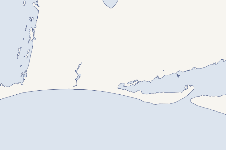
Indian Pass & Indian Lagoon at a glance
- Who permits it
- Gulf County. Indian Pass is unincorporated.
- Call first
- Gulf County Planning, (850) 227-9562
- The water
- Indian Lagoon, a shellfish harvesting area, plus the Gulf beach and the inlet to St. Vincent Sound
- Local rule to know
- Lagoon lots carry a 50-foot high-quality wetland setback.
Get to know your waterfront
Indian Pass sits at the east end of Gulf County, where the quiet, gently sloping beach of Indian Peninsula meets the inlet to St. Vincent Sound. Behind it lies Indian Lagoon, a shellfish harvesting area, with Money Bayou to the west. Lagoon lots carry a 50-foot high-quality wetland setback, and the inlet end eroded hard in Michael while the beach to the west held.
GNIS Domestic Names, Florida (DomesticNames_FL.txt) · Shellfish Harvesting Area Status - Central Gulf (published October 24, 2026) · Gulf County Land Development Regulations (adopted 02/23/1993, revised 08/27/2019), Article IV · Hurricane Michael Post-Storm Beach Conditions and Coastal Impact Report (April 2019)
Match the plan to your kind of shoreline
Indian Pass has four kinds of waterfront, and each points to a different first step. Find yours in the table before anyone prices a seawall or bulkhead.
| Shoreline | Michael record | Planning focus |
|---|---|---|
Indian Peninsula beach (R134 to R159) | Minor erosion; a wide beach, low dunes and a gentle offshore slope damped the waves | Dune care and CCCL rules |
Inlet end at Indian Pass (R159 to R161) | Major erosion as surge poured into St. Vincent Sound and currents scoured the dune toe | Treat it as inlet property and inspect after storms |
Money Bayou | 150 feet of bulkheads took major damage; a timber bridge and 170 feet of road were destroyed | Check bulkhead toe scour and tiebacks |
Indian Lagoon side | No lagoon-only count; along this coast, 127 homes had damage beneath raised floors | 50-foot wetland setback, shellfish water, marsh edges |
Table sources: DEP erosion ratings DEP Michael damage
Money Bayou holds the county’s clearest bulkhead failure
DEP rated 150 feet of Money Bayou bulkheads at Level 3, major damage, near a high-water mark of +12.2 feet NAVD88 (the national survey datum). It is one of the few documented bulkhead failures in Gulf County from Michael. DEP Michael report
After any surge, have someone check the toe (where the wall meets the bottom) for washed-out sand. Also have the tiebacks (rods that anchor the wall to the land) checked for movement. The tieback guide explains what an inspector looks for.
The lagoon setback and shellfish water
Gulf County sets a 50-foot protection zone inland from high-quality wetlands and names Indian Pass Lagoon at 50 feet. Lots of record from before 1992 that cannot meet it may get a smaller buffer. LDR Sec. 4.01.04 A separate policy requires a 50-foot buffer on every newly platted lot on Indian Lagoon. Future Land Use Policy 1.1.10
FDACS classifies Indian Lagoon as Shellfish Harvesting Area 15, mostly conditionally approved, and public bars have been closed since July 31, 2020. FDACS classification Expect water-quality questions on any dock or shoreline work near these beds.
Takeaway: On Indian Lagoon, plan within the setback and think marsh first. Gulf County already prohibits new vertical seawalls in coastal areas and encourages native plants and riprap. Policy 1.4.5
Living shoreline options that suit a quiet lagoon
Florida exempts planting native wetland plants along 500 feet or less of eroding shoreline, reaching no more than 10 feet out past the mean high water line. A low breakwater of shell, rock or reef balls can be added if it meets the rule’s limits. Rule 62-330.051(12)(e)
On the federal side, Nationwide Permit 54 covers living shorelines in low- to mid-energy coastal waters with a strong biological component. 2026 NWP 54 Start with the living shoreline guide, and see how bay owners in Port St. Joe weigh the same choice.
The beach and inlet ends
Indian Peninsula from R150 to R162 is 2.6 miles of eroding beach that DEP does not rate critical. DEP erosion status Gulf County’s CCCL rounds Cape San Blas and ends at the southwest bank of Indian Pass. Rule 62B-26.016 Beachfront work seaward of that line goes through DEP, so read the Gulf-front armoring guide first.
DEP also names Indian Pass an important winter foraging site for federally listed shorebirds, which can add timing conditions to a permit. DEP beach plan The county permit offices are listed on the Gulf County guide, the state steps on the permit guide, and the next stretch west on the Cape San Blas page.
What could the work cost?
No priced living shoreline or bulkhead job from Indian Pass turned up in public records. When you compare bids, ask each contractor to price a marsh-edge option next to any wall repair. Ask them to list water-quality controls on their own line too, because the lagoon is shellfish water.
No public record found in Bay or Gulf County shows what a private homeowner paid per foot for a seawall. This guide shows real public bids, FEMA worksheets and fee schedules instead, each with its year, place and scope.
Compare quotes and plan a budget →Find the relevant permits and records
| Starting point | What to resolve | Prepare and look up |
|---|---|---|
Gulf County Planning Department | Where the 50-foot lagoon wetland setback falls on your lot and whether a pre-1992 lot qualifies for a smaller buffer. | Survey showing the wetland edge or mean high water line, plus the plat date. (850) 227-9562. |
Gulf County Building Department | County permit for docks, bulkheads and other structures in unincorporated Indian Pass. | Every checklist document with an emailed application; (850) 229-8944 ext. 1. Online permit search through CitizenServe is announced for November 9. |
DEP Northwest District, Panama City branch | State exemption or permit for lagoon, bayou and living shoreline work. | Planting plan, any sill or breakwater detail and photos of the bank. (850) 872-4375. |
FDACS shellfish field office, Apalachicola | Current status of the Indian Lagoon shellfish areas near your dock. | Area numbers 1512, 1542, 1552 and 1506. (850) 653-8317. |
An Indian Pass and Indian Lagoon checklist
Use this list to line up the facts about your lot before you request bids.
Name your shoreline type
Decide whether the lot faces the open beach, the inlet, Money Bayou or the lagoon. Michael treated each one differently.
Hurricane Michael Post-Storm Beach Conditions and Coastal Impact Report (April 2019)
Locate the wetland edge
The setback is measured from the agency wetland line or annual mean high water, whichever is farther inland. Ask your surveyor to show it on the plan.
Gulf County Land Development Regulations (adopted 02/23/1993, revised 08/27/2019), Article IV
Inspect bayou bulkheads soon after a surge
The worst bulkhead damage on record in this area was on Money Bayou. Owners there should look for soil loss behind the cap, a leaning face or new gaps at the toe.
Hurricane Michael Post-Storm Beach Conditions and Coastal Impact Report (April 2019)
Check coastal barrier and refuge limits
Federal flood insurance is generally barred inside Coastal Barrier Resources System units, so check the FWS mapper. St. Vincent National Wildlife Refuge, reached by boat from the ramp at the end of County Road 30-B, is an Outstanding Florida Water, where permits must be clearly in the public interest.
Federal Flood Insurance and CBRA · St. Vincent National Wildlife Refuge · Rule 62-302.700 Special Protection, Outstanding Florida Waters, Outstanding National Resource Waters · Florida Statutes s. 373.414 (2026 Florida Statutes)
Plan your Indian Pass project
Share whether you face the beach, the inlet, Money Bayou or the lagoon, and get help planning a shoreline that fits the setback.
Built on Bay and Gulf County permit rules, public records and storm data.
Indian Pass & Indian Lagoon project questions
Can I replace my lagoon bulkhead with a new seawall?
Gulf County’s plan prohibits new vertical seawalls in coastal areas, and it does not say how it treats replacing an existing wall. Ask County Planning about your structure before ordering a design.
Why do storm warnings so often change at Indian Pass?
Forecasters use Indian Pass as a warning breakpoint. Idalia’s Tropical Storm Warning ran from Mexico Beach to Indian Pass, and Helene’s Storm Surge Warning covered the coast west of Indian Pass to Mexico Beach.
Tropical Cyclone Report: Hurricane Idalia (AL102023) · Tropical Cyclone Report: Hurricane Helene (AL092024)
How high did Michael’s water get here?
USGS marks along this mainland ran from +10.0 to +11.4 feet NAVD88, with +12.2 feet just west of Money Bayou and +9.5 feet inside Indian Pass. NHC estimated 6 to 9 feet of surge above ground from Indian Pass east.
Hurricane Michael Post-Storm Beach Conditions and Coastal Impact Report (April 2019) · Tropical Cyclone Report: Hurricane Michael (AL142018), 7-11 October 2018
What tide range should a lagoon design assume?
NOAA’s Indian Pass station lists a mean range of about 1.1 feet and a great diurnal range of about 1.3 feet. Storm surge, not the daily tide, sets the loads that matter.
Keep planning
Nearby waterfront guides
Cape San Blas & St. Joseph Peninsula, Port St. Joe & St. Joseph Bay, St. Joe Beach, Beacon Hill & WindMark
Show sourcesHide sources
- GNIS Domestic Names, Florida (DomesticNames_FL.txt)Source reviewed 2026-10-28
- Shellfish Harvesting Area Status - Central Gulf (published October 24, 2026)Source reviewed 2026-10-28
- Gulf County Land Development Regulations (adopted 02/23/1993, revised 08/27/2019), Article IVSource reviewed 2026-10-28
- Hurricane Michael Post-Storm Beach Conditions and Coastal Impact Report (April 2019)Source reviewed 2026-10-28
- Gulf County Comprehensive Plan, Chapter 1 Future Land Use ElementSource reviewed 2026-10-28
- 62-330.051 Exempt ActivitiesSource reviewed 2026-10-27
- Reissuance and Modification of Nationwide Permits (full text), NWP 54Source reviewed 2026-10-27
- Rule 62B-26.016 Description of the Gulf County Coastal Construction Control LineSource reviewed 2026-10-28
- Strategic Beach Management Plan: Panhandle Gulf Coast Region (August 2026)Source reviewed 2026-10-28
- Planning & Development - Gulf County, FLSource reviewed 2026-10-28
- Building Department - Gulf County, FLSource reviewed 2026-10-28
- Northwest District | Florida Department of Environmental ProtectionSource reviewed 2026-10-28
- Federal Flood Insurance and CBRASource reviewed 2026-10-28
- St. Vincent National Wildlife RefugeSource reviewed 2026-10-28
- Rule 62-302.700 Special Protection, Outstanding Florida Waters, Outstanding National Resource WatersSource reviewed 2026-10-28
- Florida Statutes s. 373.414 (2026 Florida Statutes)Source reviewed 2026-10-27
- Tropical Cyclone Report: Hurricane Idalia (AL102023)Source reviewed 2026-10-28
- Tropical Cyclone Report: Hurricane Helene (AL092024)Source reviewed 2026-10-28
- Tropical Cyclone Report: Hurricane Michael (AL142018), 7-11 October 2018Source reviewed 2026-10-28
- NOAA CO-OPS station 8728852 datumsSource reviewed 2026-10-28